Shasta's (Almost) All Ass
May 24-26, 2002
Climbers: Matthew Reagan, Paul Rozelle, and The Octopus.
This expedition is dedicated
to Simon Karecki (1972-2001)
There's something about big mountains that keep drawing you back.
After getting whipped during Shastarama
2001, we figured that we merely needed to come back during prime
climbing season to reap all the benefits of big vertical and deep
snow. Nearly three feet of fresh the week before guaranteed a weekend
free of dust and suncups (although increasing the avalanche danger),
and we seemed good to go. The weather service suggested problems, but
as the weekend approached the forecast became milder.
Well, we made a go of it!
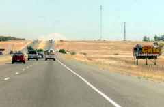 Paul and I hit the
road early Friday morning, zooming up I-5 on a crystal clear morning.
Clearer than I'd seen the Valley in a long time, and clear enough that
our goal appeared soon after we'd left Sacramento (right). The photo
was taken from over 130 miles away, and has only minimal digital
enhancement. We made excellent time and anticipated excellent
weather. Of course, the first of a few logistical blunders was
noticed at a food stop in Redding--where's my clothing bag? Ugh.
Working a more-than-full-time job really puts a dent in planning and
preparation. I knew I'd forgotten something...
Paul and I hit the
road early Friday morning, zooming up I-5 on a crystal clear morning.
Clearer than I'd seen the Valley in a long time, and clear enough that
our goal appeared soon after we'd left Sacramento (right). The photo
was taken from over 130 miles away, and has only minimal digital
enhancement. We made excellent time and anticipated excellent
weather. Of course, the first of a few logistical blunders was
noticed at a food stop in Redding--where's my clothing bag? Ugh.
Working a more-than-full-time job really puts a dent in planning and
preparation. I knew I'd forgotten something...
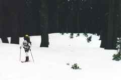 A stop at the
famous Fifth Season solved my gear problems (and let me upgrade to a
much-needed all-white wardrobe). Using the south-side routes made the
approach to the trailhead quite easy, too--an 11-mile drive up the
paved Everett Highway to the already crowded Bunny Flat, rather than
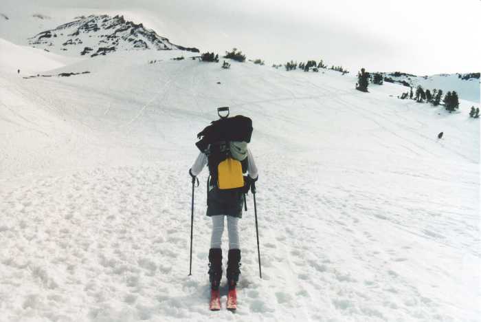
90 minutes on remote logging roads. Packed, outfitted, and somewhat
overloaded, we hit the trail by mid-afternoon (left).
A stop at the
famous Fifth Season solved my gear problems (and let me upgrade to a
much-needed all-white wardrobe). Using the south-side routes made the
approach to the trailhead quite easy, too--an 11-mile drive up the
paved Everett Highway to the already crowded Bunny Flat, rather than
90 minutes on remote logging roads. Packed, outfitted, and somewhat
overloaded, we hit the trail by mid-afternoon (left).
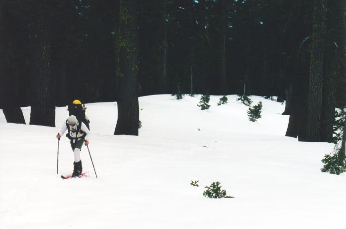
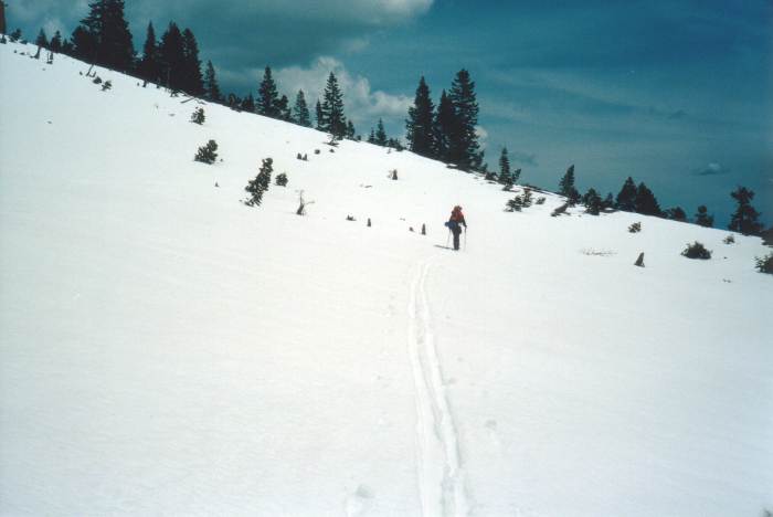
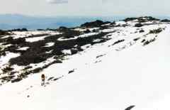
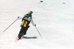
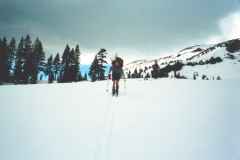 The Bunny Flat
area was well-trampled by hordes of daytrippers and Avalanche
Gulch-bound climbers. We stumbled around in the postholes, ditches,
and craters, and eventually found a clean skin track heading straight
up into the woods. The weight of our packs was quite noticable by
now. We'd cut back on a lot of gear compared to last summer (shaving
six pounds of shelter weight alone), but the addition of ski gear to
climbing gear and the extra food required for a four-day expedition
weighed us down. About a mile in, the skin tracks narrowed to a
single path, and this path seemed to be slowly bearing right. A GPS
check confirmed a routefinding blunder--the skiers were heading up to
Powder Bowl, not to Horse Camp! The hiking route had taken a hard
left at the top of the trampled meadow, while we'd worked our way up
the wooded ridge that separates Avy Gulch from Old Ski Bowl. This
gave us the opportunity for some wandering in the snowy trees, but
soon after our discovery Paul began to experience the first of many
problems with his rented Randonee setup. Something right off the shop
bench shouldn't fall off during a kick turn, should it? Several
in-field adjustments later, we skied some heavy powder and traversed
across the open slopes of the lower Avy Gulch drainage toward Horse
Camp (right).
The Bunny Flat
area was well-trampled by hordes of daytrippers and Avalanche
Gulch-bound climbers. We stumbled around in the postholes, ditches,
and craters, and eventually found a clean skin track heading straight
up into the woods. The weight of our packs was quite noticable by
now. We'd cut back on a lot of gear compared to last summer (shaving
six pounds of shelter weight alone), but the addition of ski gear to
climbing gear and the extra food required for a four-day expedition
weighed us down. About a mile in, the skin tracks narrowed to a
single path, and this path seemed to be slowly bearing right. A GPS
check confirmed a routefinding blunder--the skiers were heading up to
Powder Bowl, not to Horse Camp! The hiking route had taken a hard
left at the top of the trampled meadow, while we'd worked our way up
the wooded ridge that separates Avy Gulch from Old Ski Bowl. This
gave us the opportunity for some wandering in the snowy trees, but
soon after our discovery Paul began to experience the first of many
problems with his rented Randonee setup. Something right off the shop
bench shouldn't fall off during a kick turn, should it? Several
in-field adjustments later, we skied some heavy powder and traversed
across the open slopes of the lower Avy Gulch drainage toward Horse
Camp (right).
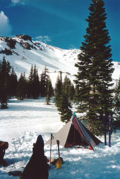
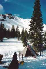 We still had hours of
sunlight to spare, though, and a full moon to look forward to after
sunset. The Megamid went up without excessive concern, and a very
comfortable camp was soon ready and fully Octopus-approved (left). We
went all-out, digging holes in the snow for comfortable sitting and
sculpting a proper kitchen area just outside the tent door. The 'Mid
is truly cavernous, with room for two people, two packs, and all the
wet and dirty gear one would normally have to stuff into a vestible.
Sure, we needed to carry 8 oz. tarps to keep our sleeping bags dry,
but the total weight still came in under 4.5 lbs. Not bad for 81
sq.ft. and room to sit up!
We still had hours of
sunlight to spare, though, and a full moon to look forward to after
sunset. The Megamid went up without excessive concern, and a very
comfortable camp was soon ready and fully Octopus-approved (left). We
went all-out, digging holes in the snow for comfortable sitting and
sculpting a proper kitchen area just outside the tent door. The 'Mid
is truly cavernous, with room for two people, two packs, and all the
wet and dirty gear one would normally have to stuff into a vestible.
Sure, we needed to carry 8 oz. tarps to keep our sleeping bags dry,
but the total weight still came in under 4.5 lbs. Not bad for 81
sq.ft. and room to sit up!
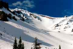 As we prepared
dinner, the setting sun illuminated the popular Avy Gulch climbing
route (right). The route is well-documented, and involves a stroll up
the Gulch toward Helen Lake on the highest of the visible moraines
(dead center in the photo, partly obscured by a curve in Casaval
Ridge) and then a climb to the right side of the Red Banks, the cliff
formation right of center. From there, you skirt the Konwakiton
Glacier headwall and bergshrund and "simply" walk up a long hill to
the summit. If the weather lets you, of course. We had more
ambitious plans. To avoid the crowds, our high camp would be in
Cascade Gulch, one drainage to the west, on a sheltered flat area
called Hidden Valley. This location would be less crowded, more
sanitary than Helen Lake, and would put us in the center of some of
the best backcountry skiing options in California. That was the
plan.
As we prepared
dinner, the setting sun illuminated the popular Avy Gulch climbing
route (right). The route is well-documented, and involves a stroll up
the Gulch toward Helen Lake on the highest of the visible moraines
(dead center in the photo, partly obscured by a curve in Casaval
Ridge) and then a climb to the right side of the Red Banks, the cliff
formation right of center. From there, you skirt the Konwakiton
Glacier headwall and bergshrund and "simply" walk up a long hill to
the summit. If the weather lets you, of course. We had more
ambitious plans. To avoid the crowds, our high camp would be in
Cascade Gulch, one drainage to the west, on a sheltered flat area
called Hidden Valley. This location would be less crowded, more
sanitary than Helen Lake, and would put us in the center of some of
the best backcountry skiing options in California. That was the
plan.
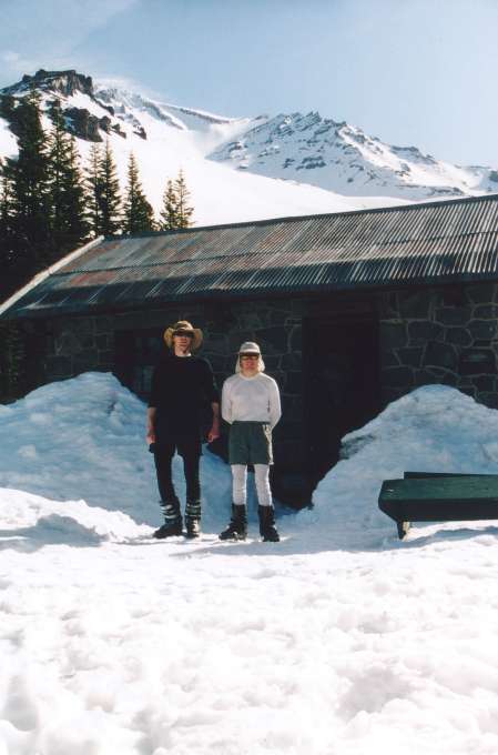
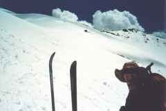
 After dinner, we
checked the weather and climbing report down at the Sierra Club's
cabin (left), where rookie caretaker Ian told us what he knew about
routes, possible weekend weather, and potential crowd concerns.
Things didn't look great, sadly. The weather report that'd been
posted all week--storms on Saturday and Sunday--turned out to be true.
Perhaps the 'Mid would get a serious test after all? However, there
were several good ways to access Cascade Gulch, many of which involved
skiing some "bonus" terrain on the way in. Mmm.
After dinner, we
checked the weather and climbing report down at the Sierra Club's
cabin (left), where rookie caretaker Ian told us what he knew about
routes, possible weekend weather, and potential crowd concerns.
Things didn't look great, sadly. The weather report that'd been
posted all week--storms on Saturday and Sunday--turned out to be true.
Perhaps the 'Mid would get a serious test after all? However, there
were several good ways to access Cascade Gulch, many of which involved
skiing some "bonus" terrain on the way in. Mmm.
(Yeah, the baggy white Capilene ain't so stylish, but I was much
happier in full California sun than I would've been in my usually
all-black outfit)
The full moon, by the way, exceeded all expectations. Rarely does one
get to take a hike to 8,000' on a big mountain, with no wind, clear
skies, and enough moonlight to make headlamps completely unnecessary.
Out on the slopes of the Gulch, well above treeline, we pulled out the
last of the Expedition Scotch and toasted our friend who couldn't be
with us.
Saturday dawned clear and calm, despite the threats of bad weather. I
hadn't slept much that night due to a combination of altitude and a
horde of hungry mice that ran in circles around the inside of the tent
and crunched away at our food supply (I never thought of hanging food
in the winter!). Chocolate-covered raisins were a bigger hit than
peanuts. They didn't get into the caffiene supply, though, and I
managed to chase away the one that was trying to chew into my
Gatorade-filled Platypus. Thanks to our big packs, we didn't want for
food despite the intrusion.
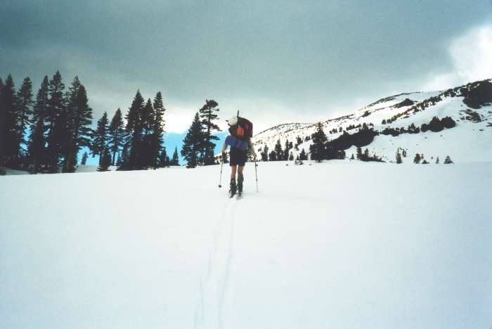
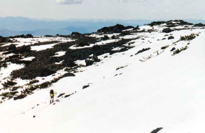
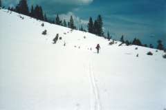 Breaking camp
around 8am, we hoisted our (still heavy) packs and followed a GPS
bearing up and around the lower reaches of Casaval Ridge toward our
high camp in Hidden Valley. The exact route wasn't entirely clear. A
few ski tracks headed down and to the west, a bunch of skin tracks
headed up the ridge to popular ski runs (Giddy-Giddy and the "windows"
in Casaval Ridge), and a snowshoe track cut a rising traverse that
best approximated the standard climbing route. This was a steep climb
that required many switchbacks (right), both due to the nature of the
terrain and due to the fact that Paul's AT kept coming apart. The
adjustments made in camp the night before wouldn't hold, and the
toepiece simply refused to deal with the forces generated by 210lbs of
skier and pack stomping a steep track up refrozen snow.
Breaking camp
around 8am, we hoisted our (still heavy) packs and followed a GPS
bearing up and around the lower reaches of Casaval Ridge toward our
high camp in Hidden Valley. The exact route wasn't entirely clear. A
few ski tracks headed down and to the west, a bunch of skin tracks
headed up the ridge to popular ski runs (Giddy-Giddy and the "windows"
in Casaval Ridge), and a snowshoe track cut a rising traverse that
best approximated the standard climbing route. This was a steep climb
that required many switchbacks (right), both due to the nature of the
terrain and due to the fact that Paul's AT kept coming apart. The
adjustments made in camp the night before wouldn't hold, and the
toepiece simply refused to deal with the forces generated by 210lbs of
skier and pack stomping a steep track up refrozen snow.
Then, as the sun warmed the snow, the skin problems began. I'd
recently purchased a set of full-width Ascensions for my new telemark
gear, and so I had fresh glue, edge-to-edge coverage, and the kind of
climbing security that is the signature of "Climbing Purple Vertical
Eaters." Paul's 55mm Euro-tip skins were light on glue, stretched
when wet, balled up tons of snow, and wouldn't bite in a steep, firm
skin track. Anyone who's struggled with substandard skins knows the
frustration of sudden releases, sideways sliding, and frequent falls.
Add an expedition pack and difficult terrain to create the perfect
skiing nightmare.
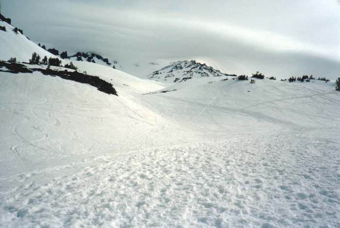
We inched up the broad gully (perfect for skiing, although that wasn't
on our minds at the moment) as the hours passed and the heat of the
day kicked in. It was only a few miles and 1,500' from Horse Camp to
the col above Hidden Valley, but heavy packs and frequent equipment
failures made the going slow. It was too steep for an uphill track,
and the AT gear wasn't going to hold together on long traverses.
Eventually, Paul simply gave up, hoisted the skis onto the already
overloaded pack, and started hoofing it.
 By mid-afternoon we
reached our goal, the col at 9,400' that provides a high entrance to
Hidden Valley (left). Despite somewhat icy conditions, I had enough
skin grip to chug straight up to the col while Paul took a safer route
high to the right. As I shuffled up the last few vertical feet, a
tremendous vista was revealed, encompassing Shastina, the Cascade
Gulch valley, the vast West Face of Shasta, and the sheltered and
spacious flats of Hidden Valley at the base of numerous skiable runs.
As promised by Ian, I was standing at the top of one such run--a wide
bowl offering 300-400' of perfect, smooth corn that ran out right by
our desired campsite. I was also standing five feet short of a
huge cornice. Uh oh, so that's why the horizon line was so
sharp. A look to the left showed me where the Cornice connected
directly to the sheer rock wall that formed the south side of the
Valley. A look to the right revealed steeper slopes and an opening in
the cornice--that dumped into a 10' wide, 45-50 degree rock-lined
chute. Hmm. That would be hard enough without the 50lb pack.
Perhaps the rope would've been a useful addition to the luggage? I
was so dejected I forget to snap any pictures of the magnificent
panorama.
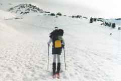
By mid-afternoon we
reached our goal, the col at 9,400' that provides a high entrance to
Hidden Valley (left). Despite somewhat icy conditions, I had enough
skin grip to chug straight up to the col while Paul took a safer route
high to the right. As I shuffled up the last few vertical feet, a
tremendous vista was revealed, encompassing Shastina, the Cascade
Gulch valley, the vast West Face of Shasta, and the sheltered and
spacious flats of Hidden Valley at the base of numerous skiable runs.
As promised by Ian, I was standing at the top of one such run--a wide
bowl offering 300-400' of perfect, smooth corn that ran out right by
our desired campsite. I was also standing five feet short of a
huge cornice. Uh oh, so that's why the horizon line was so
sharp. A look to the left showed me where the Cornice connected
directly to the sheer rock wall that formed the south side of the
Valley. A look to the right revealed steeper slopes and an opening in
the cornice--that dumped into a 10' wide, 45-50 degree rock-lined
chute. Hmm. That would be hard enough without the 50lb pack.
Perhaps the rope would've been a useful addition to the luggage? I
was so dejected I forget to snap any pictures of the magnificent
panorama.
(Looking at our GPS track on the map, I still can't fully
reconcile this experience with the map. Wind loading must've sculpted
that 200' slope, less steep on the topo than what we'd just climbed,
into a frozen wave. Inching towards the lip and peering sideways, the
landing zone seemed a dozen feet or more below the lip. I guess we
should've brought a rope and anchors for just this sort of occasion.
Ah, but there's the weight question once again!)
I shuffled back to the top of the broad couloir, meeting Paul just as
he made it to the top, and broke the bad news. Yep, the reports of
"wind loading from all directions" were true, and our ambition had
kicked our sorry asses. Paul skied down and to the west a bit,
checking out the scrubby traverse we'd seen other climbers take (this
is the exact climbing route listed on the map), but it was steep and
too scrubby to be ski-friendly. While Paul searched, I de-skinned and
clicked my Hammerheads into a stiffer setting. Something was
bothering me, but I didn't know what it was. I started down first,
cutting a wide traverse across the steep but perfectly-smooth slope
while I figured out how to tele with all this weight on my back. As I
turned around to watch Paul, I remembered one other thing about the
view of Shastina--it had a black background! The ridge we'd been
skiing down now had a black background as well, and a rumble of
thunder brought me back to my senses. Time to ski!
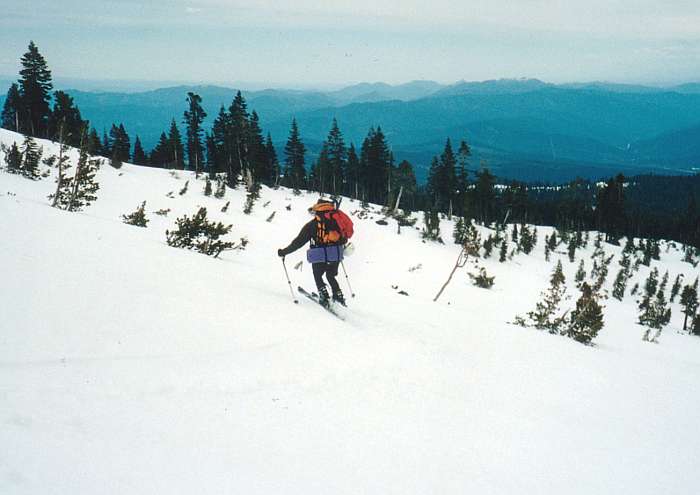
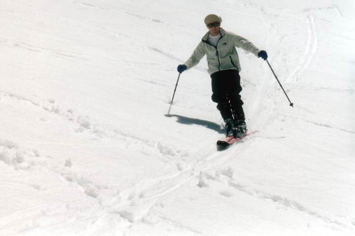
 And fine skiing it
was, despite Paul's cranky and unreliable AT gear and our heavy packs.
The gully delivered a steep face, a gentle narrows, and another steep
face. Lower down, various detours into the scrub presented themselves
and allowed for creative routefinding (right). All of this was coated
in a smooth layer of slush atop a solid base. Slushy enough to throw
a few pinwheels, but not yet deep enough to slough. A few drops of
rain, however, indicated that things would soon be softening up quite
a bit in the near future.
And fine skiing it
was, despite Paul's cranky and unreliable AT gear and our heavy packs.
The gully delivered a steep face, a gentle narrows, and another steep
face. Lower down, various detours into the scrub presented themselves
and allowed for creative routefinding (right). All of this was coated
in a smooth layer of slush atop a solid base. Slushy enough to throw
a few pinwheels, but not yet deep enough to slough. A few drops of
rain, however, indicated that things would soon be softening up quite
a bit in the near future.
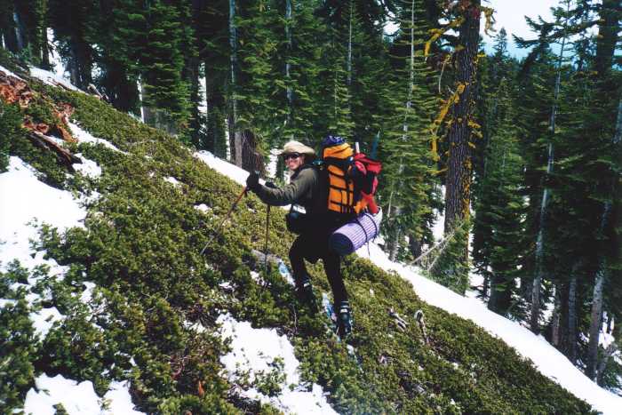
We kept an eye on the GPS, stopping at the waypoint we'd set as we
left our woods traverse. Here, we decided to go a little lower to
avoid the rolling traverses that sucked up so much energy that
morning. The lower, steeper face had fewer trees, though, and
therefore more sun exposure and less snow.  Paul, still,
accustomed to New England bushwacking ways (and skiing rented gear)
didn't see a problem with this (left). Knowing how nasty volcanic
rocks can be to new, lightweight tele skis, I found a less direct but
better-covered path through the shrubbery. We found the lower
traverse and followed the old ski tracks across the Casaval gullies
and back to Horse Camp, where we claimed our old campsite.
Paul, still,
accustomed to New England bushwacking ways (and skiing rented gear)
didn't see a problem with this (left). Knowing how nasty volcanic
rocks can be to new, lightweight tele skis, I found a less direct but
better-covered path through the shrubbery. We found the lower
traverse and followed the old ski tracks across the Casaval gullies
and back to Horse Camp, where we claimed our old campsite.
We made it just in time, too, as the rain and hail from the
approaching storm caught us just after we'd reraised the Megamid. To
keep things dry in a floorless tent, we dug out 12-18" trenches around
our snow platform, with channels to drain water into a natural sump
(treewell) just above our campsite. We tossed our gear inside and
retreated to the Horse Camp cabin to wait out the storm. Several
storms passed through over the next few hours, dumping sleet, hail,
and plenty of rain on the still unconsolidated snow from the week
before. Wet and dejected climbers streamed down from aborted attempts
to reach Helen Lake. We set a reasonable turn-around criterium--we'll
stay if the weather clears in time for dinner. Luckily, it
did.
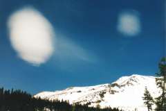
 That night, we
slept better despite occasional incursions by more rogue rodents (I
had no food in my pack, but apparantly chewing on my pack towel was
interesting enough for the critters). It stayed warm and damp most of
the night, but strong downslope winds appeared around 3am and by
sunrise the temperatures had dropped a bit below freezing. All the
folks we'd heard heading up at midnight, 1am, and 3am could be seen
climbing up below the Red Banks, with thick fog shrouding the top of
the couloir. As the sun rose and the clouds thinned, a lenticular
cloud could be see over the top of Sargents Ridge (right). Not a good
day for climbing, it seems.
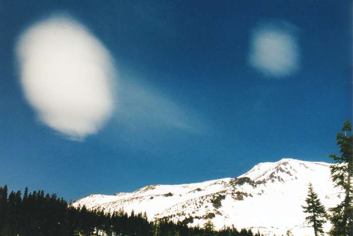
That night, we
slept better despite occasional incursions by more rogue rodents (I
had no food in my pack, but apparantly chewing on my pack towel was
interesting enough for the critters). It stayed warm and damp most of
the night, but strong downslope winds appeared around 3am and by
sunrise the temperatures had dropped a bit below freezing. All the
folks we'd heard heading up at midnight, 1am, and 3am could be seen
climbing up below the Red Banks, with thick fog shrouding the top of
the couloir. As the sun rose and the clouds thinned, a lenticular
cloud could be see over the top of Sargents Ridge (right). Not a good
day for climbing, it seems.
 But there are better
things to do on a mountain. We took a leisurely breakfast, enjoying
our luxurious campsite and working our way through the extra food.
Slowly, the sun appeared and started to work on the crusty snow. We
sorted gear, packed gear, got more weather info from Ian (heavy
thunderstorms in the afternoon/evening), and hoisted lightweight
daypacks for some serious skiing (left).
But there are better
things to do on a mountain. We took a leisurely breakfast, enjoying
our luxurious campsite and working our way through the extra food.
Slowly, the sun appeared and started to work on the crusty snow. We
sorted gear, packed gear, got more weather info from Ian (heavy
thunderstorms in the afternoon/evening), and hoisted lightweight
daypacks for some serious skiing (left).
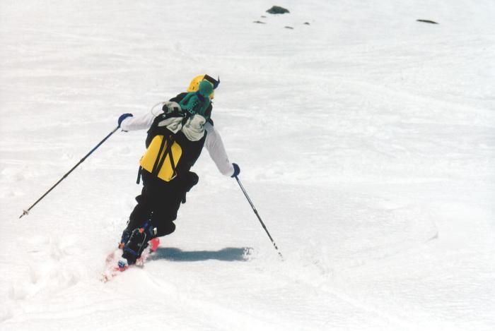
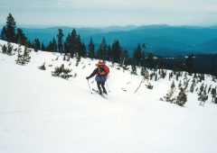
We quickly skinned a thousand feet above Horse Camp and searched for
East-facing aspects that would be soaking up the morning sun.
Compared to our struggles the day before, we easily devoured the
vertical and ended up waiting around for the sun to catch up with us.
We started with some warm-up turns on a short slope below Casaval
Ridge, and soon worked up to some leisurely cruising through smooth
corn (right). 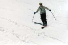 By now, the sun was
out, the sky was blue, and the heat was building, so we found a more
aggressive track and sought out bigger, steeper, and longer runs. Two
jaunts up the Avy Gulch climbers path brought us to the level slopes
of 50/50 flat around 9,700', giving us two awesome 1,000' cruises down
the morainal hills.
By now, the sun was
out, the sky was blue, and the heat was building, so we found a more
aggressive track and sought out bigger, steeper, and longer runs. Two
jaunts up the Avy Gulch climbers path brought us to the level slopes
of 50/50 flat around 9,700', giving us two awesome 1,000' cruises down
the morainal hills.
 It was so good, the
Telepus made an appearance (left).
It was so good, the
Telepus made an appearance (left).
 But backcountry
skiing is a morning activity, and soon after lunchtime the clouds
started to build once again (right). We stayed to skiers right all
the way down the Gulch, carving through corn, slush, slop, and the
postholed climbers' track on the way back to the campsite.
But backcountry
skiing is a morning activity, and soon after lunchtime the clouds
started to build once again (right). We stayed to skiers right all
the way down the Gulch, carving through corn, slush, slop, and the
postholed climbers' track on the way back to the campsite.
 We broke camp,
shouldered those heavy packs (a bit lighter due to food donations),
and skied the well-beated path back to Bunny Flat. The famous Shasta
Lemurians sent out an escort of UFOs to say goodbye (left). We still
had one day left, and after a good night's sleep in Livermore, we
headed out for more skiing at Tioga Pass.
We broke camp,
shouldered those heavy packs (a bit lighter due to food donations),
and skied the well-beated path back to Bunny Flat. The famous Shasta
Lemurians sent out an escort of UFOs to say goodbye (left). We still
had one day left, and after a good night's sleep in Livermore, we
headed out for more skiing at Tioga Pass.
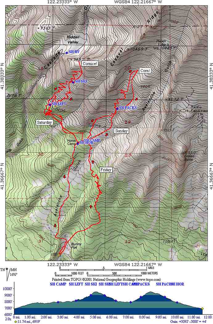
Expedition Map 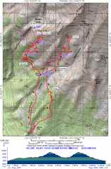
So what did we learn on this trip?
- Climb or ski? To do both requires a lot of gear. We went
"lighter" this time, but made up for that saved weight by hauling the
ski equipment. A six-pound rope could've solved the cornice problem,
but that would have been more weight. A longer trip with a
permanent base seems to be one way to deal with multiple sets of toys,
with skiing day trips and a separate climbing expedition (with or
without a high camp). If we'd taken the detour to Hidden Valley, we
would have arrived at the "end" of the ski day, would've had Sunday as
a climbing day, and only Monday would have allowed for serious ski
time, most of it with a full pack. So much terrain, so little time!
The other option is to be realistic about what one is trying to
accomplish. The fact that we climbed twice the vertical in half the
time on Sunday compared to Saturday shows that the "standard" rules
for computing time-distance-altitude don't properly account for pack
weight. Then, there's #2.
- Invest in the best gear. Rentals suck. We probably wasted at
least an hour on Saturday due to skin/binding problems. The
psychological toll of cranky gear is much harder to deal with than the
physical toll of a ski haul. You want wide skins, fresh skin glue,
well-fitted boots, and bindings you trust. Or, you want quality
lightweight gear that gives you freedom and speed. Yeah it costs
money, but so does getting up to the mountains (especially for those
who travel). Pay now or pay later.
- Look into special ski routes. Ritchin's ski route, a lower
traverse into Cascade Gulch, would have involved much longer stretches
of steep skinning (see #2), but we wouldn't have had to deal with a
cornice and climber-style routefinding. We probably could have made
it around the west side of the gully (the standard climbing route)
with only moderate frustration, but then again, we were probably an
hour too late to get the camp set up in time to avoid the
thunderstorms.
- AT gear doesn't seem as comfortable on more rolling and variable
terrain, so this should be part of route selection (or gear selection,
perhaps). A Hammerhead in
position #1 skis pretty well, while an AT binding needs to be locked
down.
- Create new rice-based meals. The best food we ate was the
lightest and simplest. There's better powdered bullion out there than
the cubes of salt and yellow food coloring, so use it! Perhaps I
should look into a food dehydrator...
I hope I get a chance to test these hypotheses in June with an
east-side ski expedition!
photos by Matthew Reagan and Paul Rozelle
Back to Outdoor Adventures
 Paul and I hit the
road early Friday morning, zooming up I-5 on a crystal clear morning.
Clearer than I'd seen the Valley in a long time, and clear enough that
our goal appeared soon after we'd left Sacramento (right). The photo
was taken from over 130 miles away, and has only minimal digital
enhancement. We made excellent time and anticipated excellent
weather. Of course, the first of a few logistical blunders was
noticed at a food stop in Redding--where's my clothing bag? Ugh.
Working a more-than-full-time job really puts a dent in planning and
preparation. I knew I'd forgotten something...
Paul and I hit the
road early Friday morning, zooming up I-5 on a crystal clear morning.
Clearer than I'd seen the Valley in a long time, and clear enough that
our goal appeared soon after we'd left Sacramento (right). The photo
was taken from over 130 miles away, and has only minimal digital
enhancement. We made excellent time and anticipated excellent
weather. Of course, the first of a few logistical blunders was
noticed at a food stop in Redding--where's my clothing bag? Ugh.
Working a more-than-full-time job really puts a dent in planning and
preparation. I knew I'd forgotten something...