Shasta's Not Ass
August 24-26, 2001
Climbers: Matthew Reagan, Paul Rozelle, and The Octopus.
This expedition is dedicated
to Simon Karecki (1972-2001)
Despite all of the gory, melodramatic mountaineering literature out
there, it still takes personal experience to convince oneself that
climbing up big mountains is hard. Part of it is physical.
You can't drag yourself and 40lbs of gear up 7,000' of vertical
without some kind of training. Part of it is logistical. Unless your
gear works, the weather holds, and the route is clear, you're not
going anywhere fast. Part of it is psychological. Will you even care
about climbing the damn mountain by the third day? Will you be able
to accurately judge objective hazards in unpleasant situations?
 Experience is the best
way to answer these questions, so we decided to get some on
Mt. Shasta. Located in far northern California, this stratovolcano
looms 14,161' above sea level, 11,000' above the town of Mt. Shasta,
and 3,000' above any of its neighboring mountains. In the Cascades
it's second in height only to Rainier, and if you add up the total
volume, is actually larger. However, the warmer and dryer California
climate makes it a much friendlier mountain, with fewer crevasses,
more stable snow, and sunnier weather in between the famous
windstorms. A perfect place to practice, and only five hours from
home!
Experience is the best
way to answer these questions, so we decided to get some on
Mt. Shasta. Located in far northern California, this stratovolcano
looms 14,161' above sea level, 11,000' above the town of Mt. Shasta,
and 3,000' above any of its neighboring mountains. In the Cascades
it's second in height only to Rainier, and if you add up the total
volume, is actually larger. However, the warmer and dryer California
climate makes it a much friendlier mountain, with fewer crevasses,
more stable snow, and sunnier weather in between the famous
windstorms. A perfect place to practice, and only five hours from
home!
Our original expedition was to have occured in June, during what
looked like excellent corn-skiing conditions. Sadly, tragedy struck
and one member of our three-man team wasn't able to join us. We
postponed the trip until August, hoping that the record warm
temperatures and fierce solar flux wouldn't trash the mountain by that
time. Sadly, they did, but we decided to go anyway. A summer of gear
purchases and upgrades, high-altitude and long-distance hiking, and
anticipation eventually led to leaving the Bay Area in heavy rush-hour
traffic on Friday the 24th.
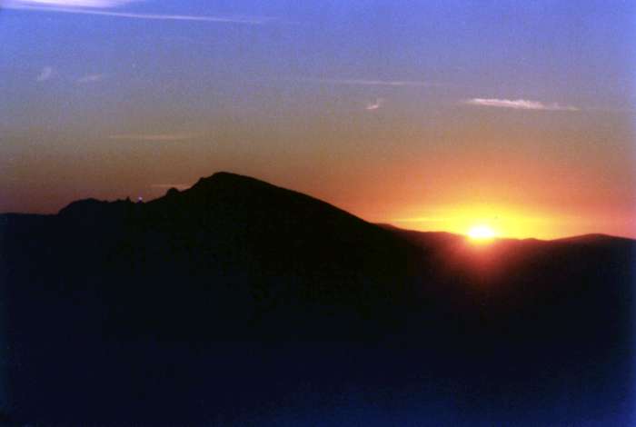
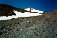
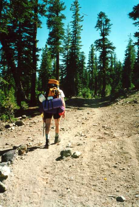
 The drive up I-5 was as flat and boring as expected,
but we made good time even with a few stops and we were at the
trailhead fully loaded and permitted well before sunset. Late-day
clouds shrouded Shasta's flanks as we started our climb from 7,200',
but the weather overall was warm, clear, and calm. Perfect
California. We followed the Brewer Creek trail up toward treeline
(left), and struck out along an old, abandoned jeep path to search for
campsites among the last few clumps of full-sized trees. We scored
big with a gorgeous, well-used site around 8,000'--close to water,
completely sheltered by large trees, and with unobstructed views of
the east face of Shasta just steps away. We settled in for the night
after an hour of wrestling with our rented four-season mountaineering
tent and building a small, hot fire for entertainment.
The drive up I-5 was as flat and boring as expected,
but we made good time even with a few stops and we were at the
trailhead fully loaded and permitted well before sunset. Late-day
clouds shrouded Shasta's flanks as we started our climb from 7,200',
but the weather overall was warm, clear, and calm. Perfect
California. We followed the Brewer Creek trail up toward treeline
(left), and struck out along an old, abandoned jeep path to search for
campsites among the last few clumps of full-sized trees. We scored
big with a gorgeous, well-used site around 8,000'--close to water,
completely sheltered by large trees, and with unobstructed views of
the east face of Shasta just steps away. We settled in for the night
after an hour of wrestling with our rented four-season mountaineering
tent and building a small, hot fire for entertainment.
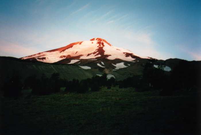
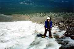
 The big three-man tent,
despite weighing about four pounds more than a two-person job, made
for comfortable camping. We didn't bother with guylines, and the
thing still shrugged off late-night downslope winds off the Shasta
glaciers. We were up at sunrise (left and right), packed everything
up, and began the second gear-haul up to our high camp. Above 8,000',
the altitude became more noticable, and those heavy packs got heavier.
Although the weight distribution seemed about right, I think I had it
easier with my caverous expedition rucksack. Paul had much more
unstable gear hanging off him and more weight sitting on his
shoulders. Of course, my pack also weighed an extra four pounds in
empty weight, so in the end it was all ass. Damn, as a day-hiker I
forget how heavy fuel, cooking gear, and communal food can be
(probably ten pounds for us). Nearly five liters of water-carrying
capacity seemed like a great idea, too, but I found myself filling it
and adding another ten pounds of weight (I can usually get by with
three liters away from camp each day). I'm glad I did some
weightlifting and lots of squats this summer.
The big three-man tent,
despite weighing about four pounds more than a two-person job, made
for comfortable camping. We didn't bother with guylines, and the
thing still shrugged off late-night downslope winds off the Shasta
glaciers. We were up at sunrise (left and right), packed everything
up, and began the second gear-haul up to our high camp. Above 8,000',
the altitude became more noticable, and those heavy packs got heavier.
Although the weight distribution seemed about right, I think I had it
easier with my caverous expedition rucksack. Paul had much more
unstable gear hanging off him and more weight sitting on his
shoulders. Of course, my pack also weighed an extra four pounds in
empty weight, so in the end it was all ass. Damn, as a day-hiker I
forget how heavy fuel, cooking gear, and communal food can be
(probably ten pounds for us). Nearly five liters of water-carrying
capacity seemed like a great idea, too, but I found myself filling it
and adding another ten pounds of weight (I can usually get by with
three liters away from camp each day). I'm glad I did some
weightlifting and lots of squats this summer.
Shasta, however, is not ass. We found a great sheltered campsite in
the scrub around 9,200' and decided this was as good as it gets. We
later found higher sites, but this one had the benefit of shelter from
tall scrub, meaning we wouldn't have to set up an elaborate guying
system to protect against surprise weather. We got the tent up
quicker this time, dumped all of the camp gear inside of it, and
headed up for an acclimatization hike.
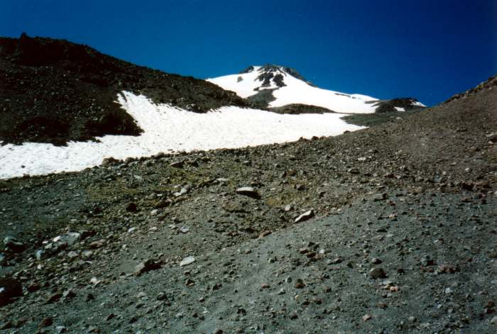
 On our way up to
the Hotlum-Wintun snowfield (right), we began to get a real
appreciation for how big this thing is. Landmarks passed
rapidly as we climbed, and the surrounding peaks dropped away as we
headed to 10,000' and beyond. However, the summit didn't get any
closer. The route ahead simply tilted upward as we approached the
base of the real climbing, and those pleasant white snowfields soon
revealed their true texture--bathtub-sized suncups and waist-high
penitientes. He hit 11,000' and found only a narrow tongue of the
snowfield accessible, since everything had melted way back over the
past few months. What remained was a sea of scree, an ocean of
ball-bearing pebbles, and unconsolidated sand that made uphill
progress frustrating at best. What a great idea to scout as much of
the route as possible beforehand--if we hadn't, this could have made
for some very difficult pre-dawn routefinding on summit day.
On our way up to
the Hotlum-Wintun snowfield (right), we began to get a real
appreciation for how big this thing is. Landmarks passed
rapidly as we climbed, and the surrounding peaks dropped away as we
headed to 10,000' and beyond. However, the summit didn't get any
closer. The route ahead simply tilted upward as we approached the
base of the real climbing, and those pleasant white snowfields soon
revealed their true texture--bathtub-sized suncups and waist-high
penitientes. He hit 11,000' and found only a narrow tongue of the
snowfield accessible, since everything had melted way back over the
past few months. What remained was a sea of scree, an ocean of
ball-bearing pebbles, and unconsolidated sand that made uphill
progress frustrating at best. What a great idea to scout as much of
the route as possible beforehand--if we hadn't, this could have made
for some very difficult pre-dawn routefinding on summit day.
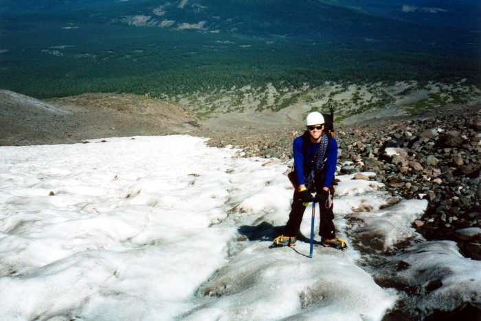
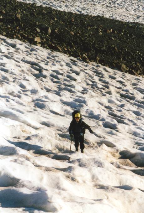
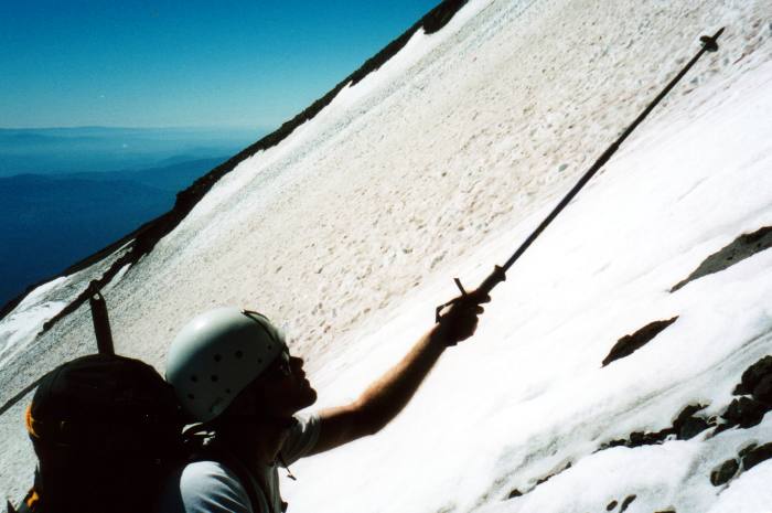
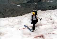
 We bailed out of the
quicksand just below the main body of the snowfield, and decided to
test our luck on the frozen stuff. Arrayed in helmets, crampons, and
ice axes, we still found the climbing more difficult than expected.
The grade of the snowfield isn't very impressive between 11,000' and
12,000', but the suncups meant constant ascents and descents across
the icy bowls, or heel-toe tightrope walking along the sharp ridges.
We ascended the snowfield in a rising traverse to about 11,500' or so,
enjoying the views and getting our snow legs back under us. A quick
glance to the north made it very clear that bringing skis on this trip
would have been pointless (right).
We bailed out of the
quicksand just below the main body of the snowfield, and decided to
test our luck on the frozen stuff. Arrayed in helmets, crampons, and
ice axes, we still found the climbing more difficult than expected.
The grade of the snowfield isn't very impressive between 11,000' and
12,000', but the suncups meant constant ascents and descents across
the icy bowls, or heel-toe tightrope walking along the sharp ridges.
We ascended the snowfield in a rising traverse to about 11,500' or so,
enjoying the views and getting our snow legs back under us. A quick
glance to the north made it very clear that bringing skis on this trip
would have been pointless (right). 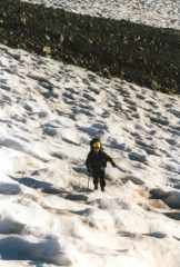 Furthermore, we
also realized that the "good" snow surface conditions we were
experiencing (an inch of corn on top of a rock-hard base) might not be
there for us early in the day. Other options began to enter our
heads. We turned around at 3:30pm and practiced descending with a
trip all the way down to the foot of the snowfield, then blazed down
the soft scree to hit camp in about an hour.
Furthermore, we
also realized that the "good" snow surface conditions we were
experiencing (an inch of corn on top of a rock-hard base) might not be
there for us early in the day. Other options began to enter our
heads. We turned around at 3:30pm and practiced descending with a
trip all the way down to the foot of the snowfield, then blazed down
the soft scree to hit camp in about an hour.
Around this point, we realized that this was hard. We'd spent a
couple hours climbing and the mountain didn't seem to have gotten any
closer. We'd accumulated lots of valuable route information (and
realized that the standard route was useless in these conditions) and
had everything up to 12,000' sorted out for the next morning. While
neither of us got altitude sick, it still took its toll. Paul, just
in from the swampy Northeast, was getting dessicated by the high
California air and scorching sun. Six liters of water a day didn't
seem to be enough. I'd sorted out water and sun issues with my High
Sierra practice trips, but a second day at altitude really wore me
down with the typical altitude-induced anorexia. I was convinced to
force down extra calories despite the fact everything tasted "like
ass," and then spent the next twelve hours with indigestion. Mmm. We
organized our gear and went to bed around 10pm, with an alarm set for
3am. I slept a little. Not much, though.
 The alarm woke us at
3am to cool, windy, and clear weather. A full array of stars greeted
us as we huddled around a camp stove waiting for hot liquid. I
fumbled with my pack, still dizzy from lack of R.E.M. sleep, and
managed to leave stuff behind in the tent despite an hour of
organizing the night before. We were off by 4am as planned, and by
the light of our headlamps retraced our steps from the day before up
toward the snowline.
The alarm woke us at
3am to cool, windy, and clear weather. A full array of stars greeted
us as we huddled around a camp stove waiting for hot liquid. I
fumbled with my pack, still dizzy from lack of R.E.M. sleep, and
managed to leave stuff behind in the tent despite an hour of
organizing the night before. We were off by 4am as planned, and by
the light of our headlamps retraced our steps from the day before up
toward the snowline.
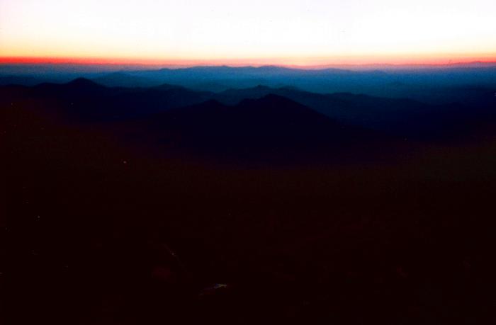
We made excellent time, and the sun didn't light the sky (left) until
we were at the foot of the snowfield. We discussed the relative
merits of getting onto the snow early or late, and eventually realized
that avoiding the snow as much as possible might be the best route. 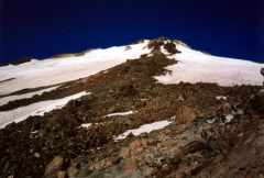 Of course, "best" is relative--all accounts suggested
that ridge routes aren't suitable this time of the year, but
considering the conditions of the snow surface, we didn't have much
choice. So, we chose bad over worse with a rising traverse across the
lower snowfield up to the base of the rock rib that separates the
Hotlum-Wintun snowfield from the Wintun Glacier (right).
Of course, "best" is relative--all accounts suggested
that ridge routes aren't suitable this time of the year, but
considering the conditions of the snow surface, we didn't have much
choice. So, we chose bad over worse with a rising traverse across the
lower snowfield up to the base of the rock rib that separates the
Hotlum-Wintun snowfield from the Wintun Glacier (right).
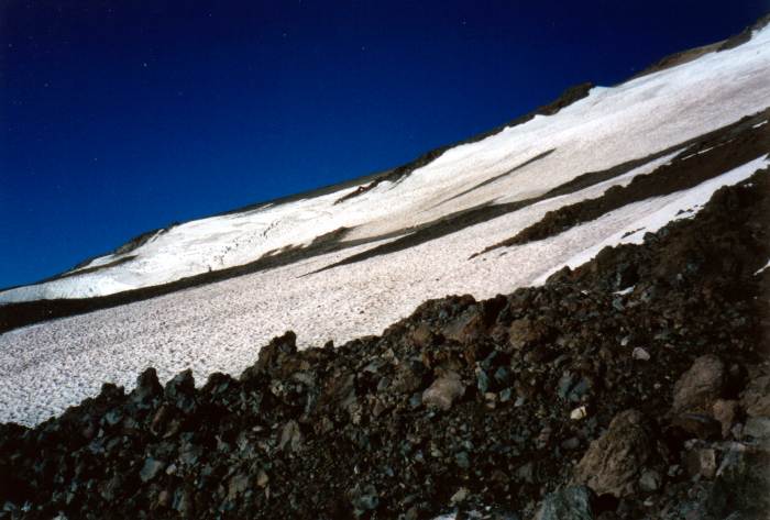
 At least we still had
our New England roots to fall back on. By the standards of many of my
Californian friends, this was a ridiculous route. After the
trip, a few knowledgable folks asked me if I was looking to "break a
leg" in the talus. They were right in that it was a slow
route--slower than the mindless but steady uphill grind of snow
climbing--but at least it was a familiar sort of climbing. The
routefinding was only moderately tricky, and we ate up vertical
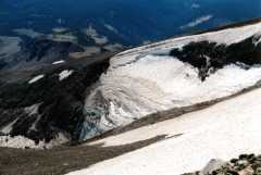
through a few hours of class 2 and easy class 3 travel. We marked our
progress by watching the dirty mass of the Wintun Glacier pass to our
left (left).
At least we still had
our New England roots to fall back on. By the standards of many of my
Californian friends, this was a ridiculous route. After the
trip, a few knowledgable folks asked me if I was looking to "break a
leg" in the talus. They were right in that it was a slow
route--slower than the mindless but steady uphill grind of snow
climbing--but at least it was a familiar sort of climbing. The
routefinding was only moderately tricky, and we ate up vertical
through a few hours of class 2 and easy class 3 travel. We marked our
progress by watching the dirty mass of the Wintun Glacier pass to our
left (left).
A use path appeared and disappeared as we climbed, with
well-constructed high-altitude campsites popping up here and here as
we ascended. I think the quality of the route correlates to whether a
particular section of the ridge would be exposed or buried in snow in
"typical" year. Those sheltered spots, usually buried, were now
loaded with loose rock from pebble-sized to man-sized. A few unsteady
scrambles ended in dangerous slips as bits of the mountain tried to
find a lower resting place. So volcanoes really are crumbly.
We could practically watch this one disintegrating in non-geological
time.
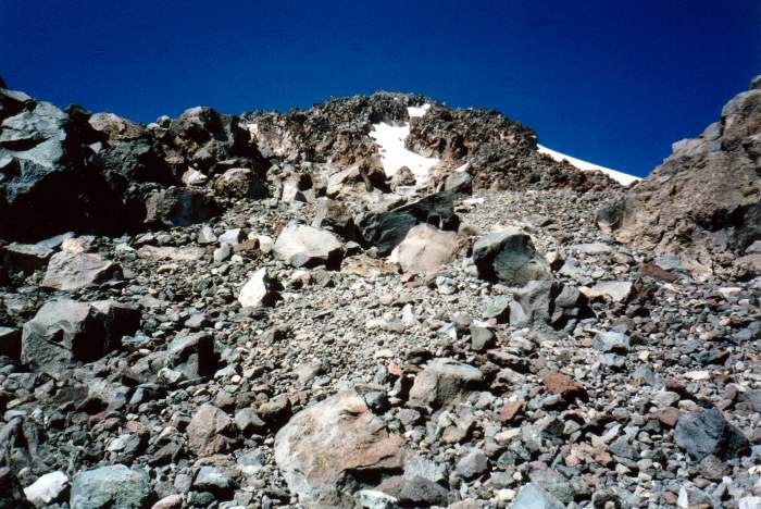
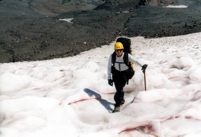
 We chugged uphill at a slow and steady pace, ascending
two steep scrambles and two extended sections of scree. Things
steepened as we approached a bench at 13,000', and we crested the top
of the rib to find that things were getting even steeper
(right). There were three choices at this point. If we stayed on the
rock, we'd have 900' of class 3 and 4 climbing to the summit plateau.
However, in the current melted-out state of things, loose rock might
be an issue, as well as the need for belays. We could head right, and
climb the steep headwall of the Hotlum-Wintun snowfield across the
bergschrund of the Hotlum Glacier. This, of course, would be
fully-belayed snowclimbing.
We chugged uphill at a slow and steady pace, ascending
two steep scrambles and two extended sections of scree. Things
steepened as we approached a bench at 13,000', and we crested the top
of the rib to find that things were getting even steeper
(right). There were three choices at this point. If we stayed on the
rock, we'd have 900' of class 3 and 4 climbing to the summit plateau.
However, in the current melted-out state of things, loose rock might
be an issue, as well as the need for belays. We could head right, and
climb the steep headwall of the Hotlum-Wintun snowfield across the
bergschrund of the Hotlum Glacier. This, of course, would be
fully-belayed snowclimbing. 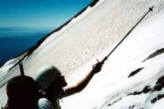 The third option was the
standard route, heading left of the rock rib and climbing the edge of
the Wintun Glacier. Conditions on this route were a big question
mark. From where we stood, we could see firm corn on firn, then a
pentientes field. Beyond that (maybe 200' up), the route turned a
corner and the conditions were unknown. The Wintun Glacier, however,
was certainly a steep climb (left).
The third option was the
standard route, heading left of the rock rib and climbing the edge of
the Wintun Glacier. Conditions on this route were a big question
mark. From where we stood, we could see firm corn on firn, then a
pentientes field. Beyond that (maybe 200' up), the route turned a
corner and the conditions were unknown. The Wintun Glacier, however,
was certainly a steep climb (left).
It was around 10:30am by this time. We had a "conservative"
turn-around time of 11am if things were looking difficult and a noon
turn-around time if the route was clear. I didn't like the looks of
the rock at all, and we didn't have any rock protection with us
anyway. We'd decided in advance that any belayed climbing would be
for practice purposes only, so the right route wasn't an option. Lack
of information about the left path soon convinced us this wasn't going
to happen. To underscore this, the only approach to the left
route was some of the worst scree we'd seen yet--golf balls at the
angle of repose that wouldn't even let you stand still, much less gain
altitude. Without even checking the snow conditions, we turned around
just above 13,000'.
(I managed to get a little information from various internet
discussion groups after returning to civilization. The rock route was
"the source of all the rockfall" on the route, so I'm glad we didn't
mess around with it. The upper Hotlum glacier was "a sheet of ice"
with crevasses and a "gaping schrund" near the top. Allegedly, the
standard route was simply steep and firm, although it got close to
some sizable fissures near the top of the Wintun. I doubt we would
have enjoyed that without at least a running belay. Also, examination
of the various photos reveals that this route would have passed
underneath the vertical wall of the Wintun bergschrund, which we could
see from below but couldn't orient with the route itself, before
hitting another section of mandatory rock.)
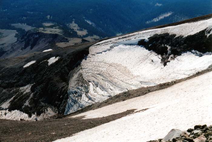
 As we turned around
to descend, we got to enjoy some of the views. We'd come quite a long
way, hadn't we? The Wintun Glacier spilled over an impressive icefall
to the south (right), while the views to the east and north gave us
pollution-stained vistas of our campsites and of other Cascade
volcanoes looming to the north. We boot-skied the scree and dropped
altitude rapidly, soon hitting the upper steep scramble on the ridge.
We stayed to the northern edge of the ridge this time, seeking
glissade routes and finding a somewhat better use-path down from the
heights. Eventually, we got a clear view of things and decided to
glissade the smooth boundary between the rock and the main snowfield.
As the sun climbed high and the effect of three days on the mountain
made our feet ache, we went for it.
As we turned around
to descend, we got to enjoy some of the views. We'd come quite a long
way, hadn't we? The Wintun Glacier spilled over an impressive icefall
to the south (right), while the views to the east and north gave us
pollution-stained vistas of our campsites and of other Cascade
volcanoes looming to the north. We boot-skied the scree and dropped
altitude rapidly, soon hitting the upper steep scramble on the ridge.
We stayed to the northern edge of the ridge this time, seeking
glissade routes and finding a somewhat better use-path down from the
heights. Eventually, we got a clear view of things and decided to
glissade the smooth boundary between the rock and the main snowfield.
As the sun climbed high and the effect of three days on the mountain
made our feet ache, we went for it. 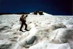 A short, steep glissade got us past one steep
downclimb. Some rock scrambling from there on another good use path
brought us to one last steep section, from which we decided to
undertake a straight-line descent route out across the snowfield. We
cramponed up and started the long process of side-stepping down
(left).
A short, steep glissade got us past one steep
downclimb. Some rock scrambling from there on another good use path
brought us to one last steep section, from which we decided to
undertake a straight-line descent route out across the snowfield. We
cramponed up and started the long process of side-stepping down
(left).
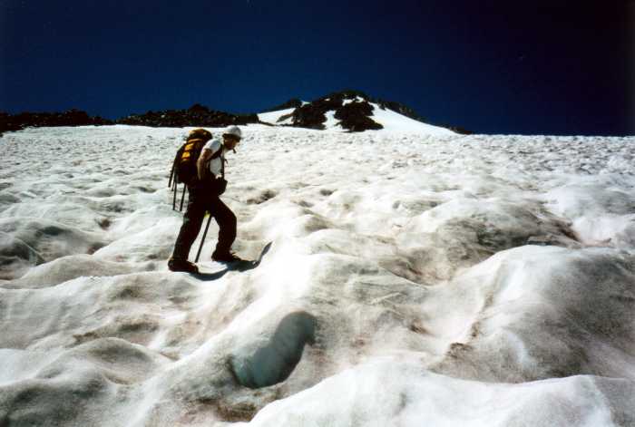
As we had the day before, we made good time on the descent despite
exhaustion and discomfort in the hot sun. We cut the snowfield
diagonally, taking it down as far as we could go before repacking the
crampons (right). While descending, two people appeared on the far
side of the snowfield. They seemed to be doing some glacier-travel
practice on the Hotlum. We never got close enough to say hello. Once
on the rock, we plunge-stepped down the sandy use path and hit our
camp by 3pm.
 By this time we were
fighting inertia. Getting everything packed up wasn't very much fun,
and the heat of the day, magnified by the lower altitude, started to
mess with our heads. Water was getting scarce, but nobody felt like
hiking over to the creek to get more. We headed down through the
meadows a bit left of our ascent route, passing our first night's
campsute and blowing past our intended turn-off at the bottom of a dry
wash. Ten minutes of backtracking brought us back to where the trail
crosses Brewer Creek, but two days of hot weather had increased the
flow to the point where it didn't look like the same stream. Taking
compass bearings suggested we were at the right place, but having seen
numerous other paths that didn't appear on the map made it
tough to decide. I think I'm going to buy that GPS after all.
By this time we were
fighting inertia. Getting everything packed up wasn't very much fun,
and the heat of the day, magnified by the lower altitude, started to
mess with our heads. Water was getting scarce, but nobody felt like
hiking over to the creek to get more. We headed down through the
meadows a bit left of our ascent route, passing our first night's
campsute and blowing past our intended turn-off at the bottom of a dry
wash. Ten minutes of backtracking brought us back to where the trail
crosses Brewer Creek, but two days of hot weather had increased the
flow to the point where it didn't look like the same stream. Taking
compass bearings suggested we were at the right place, but having seen
numerous other paths that didn't appear on the map made it
tough to decide. I think I'm going to buy that GPS after all.
The slog down to the car was simply brutal, not because of the trail
itself but because we were simply worn out. The human waste pack-out
bags provided by the Forest Service were stinking up a storm despite
being triple-wrapped. The faux-ziplocs they give you are ass,
so bring freezer-grade ziplocs when you go. We found the car at 6pm,
an hour later than expected. Ninety minutes of windy dirt roads and
empty highway brought us back to Mt. Shasta City, where cheap fast
food was all we had time for. We made it back to Livermore before
1am.
That was a long day.
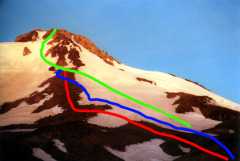 Route info: we ascended the rock ridge to the
left of the Hotlum-Wintum snowfield (red). We descended the snowfield
itself (blue). The "standard route" is in green.
Route info: we ascended the rock ridge to the
left of the Hotlum-Wintum snowfield (red). We descended the snowfield
itself (blue). The "standard route" is in green.
photos by Matthew Reagan and Paul Rozelle
Back to Outdoor Adventures
 Experience is the best
way to answer these questions, so we decided to get some on
Mt. Shasta. Located in far northern California, this stratovolcano
looms 14,161' above sea level, 11,000' above the town of Mt. Shasta,
and 3,000' above any of its neighboring mountains. In the Cascades
it's second in height only to Rainier, and if you add up the total
volume, is actually larger. However, the warmer and dryer California
climate makes it a much friendlier mountain, with fewer crevasses,
more stable snow, and sunnier weather in between the famous
windstorms. A perfect place to practice, and only five hours from
home!
Experience is the best
way to answer these questions, so we decided to get some on
Mt. Shasta. Located in far northern California, this stratovolcano
looms 14,161' above sea level, 11,000' above the town of Mt. Shasta,
and 3,000' above any of its neighboring mountains. In the Cascades
it's second in height only to Rainier, and if you add up the total
volume, is actually larger. However, the warmer and dryer California
climate makes it a much friendlier mountain, with fewer crevasses,
more stable snow, and sunnier weather in between the famous
windstorms. A perfect place to practice, and only five hours from
home!