Pemigewasset/Bond Ridge Traverse
November 6-7, 1999
Hikers: Matthew Reagan, Paul Rozelle, and The Octopus.
Once again, a major expedition took months to get off the ground.
We'd been talking about doing a big Pemigewasset Wilderness traverse
all summer, but reality intruded on more than one occasion to push the
date well into the fall. Then, the weather decided to be a problem,
with six straight rainy weekends in September and October.
And then, a few insane MITOC folks decided to raise
the bar by not only doing a Pemi Traverse, but to loop all of the
Franconia, Garfield, and Bond ridges in a single day. Two groups
pulled this off, but we really had no intention of duplicating the
feat. Maybe this was "Pemi for Pussies," but we still got what we
wanted out of the trip.
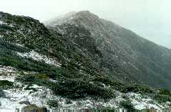
 Anyway, October 23
and 24 was the original date, but after gearing up in the face of
positive forecasts, New England got hit by an errant Nor'easter that
dumped rain, freezing rain, and snow across the mountains. We bailed
on the traverse, and instead braved the wet weather to bag North Twin
on the 24th. Not much to see in the clouds, but a fresh coat of wet
snow above 3000' reminded us what season was approaching. More
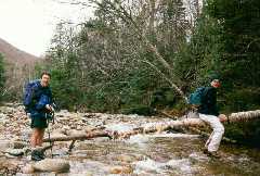
interesting than the views were the water crossings--the previous
day's 2" of rain had turned "difficult" crossings into "impossible"
ones (right). Bushwacking was mandatory, and one soft stream bank
sent me headfirst into a creek on the way down. Lesson learned:
synthetic clothing does insulate when wet!
Anyway, October 23
and 24 was the original date, but after gearing up in the face of
positive forecasts, New England got hit by an errant Nor'easter that
dumped rain, freezing rain, and snow across the mountains. We bailed
on the traverse, and instead braved the wet weather to bag North Twin
on the 24th. Not much to see in the clouds, but a fresh coat of wet
snow above 3000' reminded us what season was approaching. More
interesting than the views were the water crossings--the previous
day's 2" of rain had turned "difficult" crossings into "impossible"
ones (right). Bushwacking was mandatory, and one soft stream bank
sent me headfirst into a creek on the way down. Lesson learned:
synthetic clothing does insulate when wet!
After a Halloween break (warm and sunny, of course, since no hike was
planned), the first weekend in November looked promising, with no
major storms in sight. Gearing up once again, Paul and I spent Friday
night spotting cars and sleeping in the fly-infested confines of the
MITOC Intervale Cabin (whoever left an apple core in the trash needs
to be beaten severely).
We awoke at 6:30am, which should have been our trailhead start time,
except that alarm watches are effectively muffled by down sleeping
bags. We hit the trailhead by 8:45, and headed up the Gale River
trail to start our five-peak weekend. The going was fast and easy,
with cool temperatures, sunny skies, and excellent footing. We
decided to leave the tent behind and go light, since Guyot shelter was
likely to have space this late in the season and we had tarps as a
lightweight backup.
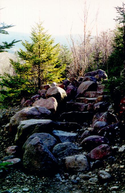
 The trail crossed the
flat ground along the Gale River quickly and directly, then began to
climb as views toward the ridge and to North Twin opened up along the
steeper sections (left). We gained the ridge top with little
difficulty, and soon heard the noise of Galehead Hut renovations.
Quite a project was underway, with the effective size of the hut being
doubled by an oddly angled addition. I remembered a news article
about the additional work being done to make the hut
handicapped-accessible in compliance with the Americans with
Disabilities Act. Now, I have to wonder why a disabled person who
successfully met the challenge of the 4+ mile hike up the rocky trail
would even consider using a ramp to access the hut itself, but
rules are rules and reason must not interfere with bureaucracy.
The trail crossed the
flat ground along the Gale River quickly and directly, then began to
climb as views toward the ridge and to North Twin opened up along the
steeper sections (left). We gained the ridge top with little
difficulty, and soon heard the noise of Galehead Hut renovations.
Quite a project was underway, with the effective size of the hut being
doubled by an oddly angled addition. I remembered a news article
about the additional work being done to make the hut
handicapped-accessible in compliance with the Americans with
Disabilities Act. Now, I have to wonder why a disabled person who
successfully met the challenge of the 4+ mile hike up the rocky trail
would even consider using a ramp to access the hut itself, but
rules are rules and reason must not interfere with bureaucracy.
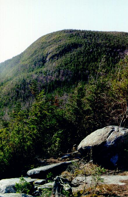
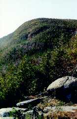 After a light lunch,
we dropped our packs and headed for Galehead itself (right). The
Frost Trail had an amazing section of blowdown that seems to have
wiped out many of the excellent campsites reported to be nearby. The
trail rose easily through the pines to a wonderful lookout ledge with
great views down to the hut and across to the Twins. We stopped for
conversation with a nice couple that fed us stories of peak-bagging,
including their own conquests, plus one anecdote about some guy who
bagged all 48 4000'ers exactly at midnight in the winter.
After a light lunch,
we dropped our packs and headed for Galehead itself (right). The
Frost Trail had an amazing section of blowdown that seems to have
wiped out many of the excellent campsites reported to be nearby. The
trail rose easily through the pines to a wonderful lookout ledge with
great views down to the hut and across to the Twins. We stopped for
conversation with a nice couple that fed us stories of peak-bagging,
including their own conquests, plus one anecdote about some guy who
bagged all 48 4000'ers exactly at midnight in the winter.
Hmm.
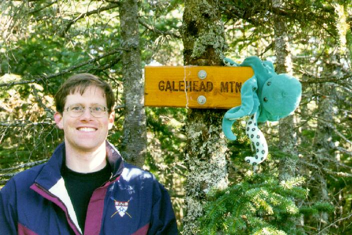
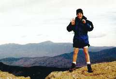
 The summit of Galehead,
sadly, was nothing special (left). Zealand has a better sign and no
less of a view. However, this marked #39 for me and another step on
The Octopus' 4000'er challenge. We hurried
back to the hut, lifted the packs once again, and attacked the
steepest part of the day's climbing.
The summit of Galehead,
sadly, was nothing special (left). Zealand has a better sign and no
less of a view. However, this marked #39 for me and another step on
The Octopus' 4000'er challenge. We hurried
back to the hut, lifted the packs once again, and attacked the
steepest part of the day's climbing.
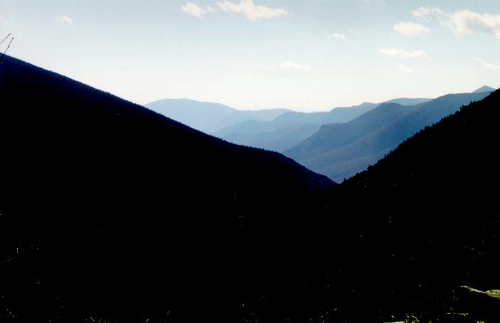
From Galehead Hut, the Twinway begins with a disappointing drop
followed by a daunting ascent. The views into the valley of Franconia
Brook (right) were small consolation. For 0.8 miles, the trail
ascends over 1000' in a steady grade to the 4902' summit. Here we saw
the first ice of the trip (enough to be annoying on the steep, rocky
trail), and also got the first sense of altitude as the Garfield Ridge
dropped away behind us and the Franconia Range became our gauge of
vertical rise. 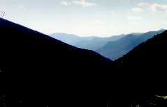 The Twinway ascended
from boreal forest to low scrub, but kept us sheltered from the wind
right to the bare summit of South Twin. This was #40 for me (below
left), and our first serious views of the weekend. The vaulted forms
of Franconia Ridge stretched out to the west, the Presidentials loomed
white and angry to the east, and the vast forested wilds of the
Pemigewasset watershed opened up to the south. We got our first view
of the Bond Ridge, and a true appreciation for how far "away from it
all" this trip would get us.
The Twinway ascended
from boreal forest to low scrub, but kept us sheltered from the wind
right to the bare summit of South Twin. This was #40 for me (below
left), and our first serious views of the weekend. The vaulted forms
of Franconia Ridge stretched out to the west, the Presidentials loomed
white and angry to the east, and the vast forested wilds of the
Pemigewasset watershed opened up to the south. We got our first view
of the Bond Ridge, and a true appreciation for how far "away from it
all" this trip would get us.
 From the South Twin summit, the Twinway angled south
toward the Twin-Guyot-Zealand col. The trail quickly leveled out,
providing for great footing and quick travel. At some point, The Octopus decided to go off on his own, and
Paul ended up doing a few miles of backtracking to recover his sorry,
eight-legged ass. However, while waiting for them to return, I found
numerous campsites just north of the Bondcliff trail junction, many of
them level, clear, and near excellent views into the valley of
Franconia Brook.
From the South Twin summit, the Twinway angled south
toward the Twin-Guyot-Zealand col. The trail quickly leveled out,
providing for great footing and quick travel. At some point, The Octopus decided to go off on his own, and
Paul ended up doing a few miles of backtracking to recover his sorry,
eight-legged ass. However, while waiting for them to return, I found
numerous campsites just north of the Bondcliff trail junction, many of
them level, clear, and near excellent views into the valley of
Franconia Brook.
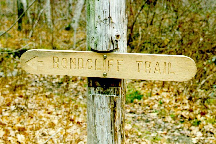
Paul and The Octopus soon returned from
their detour, and the three of us headed out to the Zealand-Guyot col
and found the Bondcliff trail junction. From here, the path moves out
onto the rocky, bare slopes of Mt. Guyot, providing amazing views of
the Western Pemi along with unrelieved exposure to the wind.
Northwesterly gusts pushed us on and off the rocky trail, and
temperatures dropped as the sun approached the edge of Franconia
Ridge. The scrub closed in around us soon after we passed the Guyot
summit cairn, and in a few hundred yards we found the spur path to the
Guyot Shelter.
A short, steep drop later, we found the platforms and structures of
the shelter, all perched on the rocky mountainside. Nice views opened
up to the east, with Mts. Tom, Field, and Willey defining the horizon.
We found the shelter occupied, but with plenty of space below the
sleeping shelf. We were fortunate to share the place with a nice
group of hikers, one of whom was training for an Aconcagua climb by
carrying an enormous pack from Zealand to Guyot and back. Enormous
pack = extra luxuries! We had light from a Coleman lantern, more
snacks and food than anyone could eat, and music from a portable
radio. A deftly rigged tarp closed off the shelter entrance, giving
us a warm, cozy place to cook, eat, and B.S. the evening away. After
dinner, the view from the shelter porch inspired us to head back to
treeline to view the stars. Of course, high clouds moved in just as
we reached the scrub on Guyot, but the experience of standing on a
mountaintop in the darkest of nights was still a remarkable
experience. The Pemi is truly dark, and the light pollution
leaking over the surrounding mountains seemed incredibly bright.
After nine solid hours of sleep (undisturbed by mice and shielded from
snoring by earplugs), we awoke at 6:30am to considerably colder
temperatures. A peek around the tarp revealed about a quarter-inch of
fresh, powdery snow and limited visibility. The Aconcagua-bound
backpacker and his companions positively bounced out of their bags and
sailed off into the fog, but Paul and I were not in quite so big a
hurry. Several quarts of hot liquid and several ounces of sugar were
needed to jump-start the packing process.
We hit the trail by 8:30, soon finding the West Bond spur and taking a
one-mile detour to the rocky, sharp summit cone of this fine little
peak. Magnificent scenery certainly must have surrounded us, but all
we saw was shades of grey and white. Our view would have encompassed
all of the western Pemi, with Owl's Head, Bond, the Bondcliffs, and
Franconia Ridge featured in a 360o view. At least the wind
had calmed a bit since the night before. And the snow was pretty.
 Backtracking to the main Bond ridge, we began the
gentle but steady climb to the Bond summit. The summit itself was
bare, with only a little snow and ice remaining around the marker
cairn. Descent was a bit tricky--after some confusion as to the
direction of the trail, we found a rocky, icy path down the west side
of the cone. A dusting of snow was enough to keep us ignorant of icy
spots, and the footbed of tumbled boulders reminded us how far it
would be to evacuate a broken ankle to the road. Surprisingly, we
descended out of the scrub, soon approaching the exposed 4000'
col between Bond and Bondcliff. The rough footing continued as we
descended below the clouds to a stiff crosswind and a great view of
our goal (left). The cliffs drop away to the west of the 4200'
ridgecrest, forming the eastern wall of the deep Bondcliff-Bond-West
Bond drainage. Through the lifting clouds, we picked up the
slide-raked slope of West Bond across the gulf, and the Franconia and
Lincoln brooks below in the valley.
Backtracking to the main Bond ridge, we began the
gentle but steady climb to the Bond summit. The summit itself was
bare, with only a little snow and ice remaining around the marker
cairn. Descent was a bit tricky--after some confusion as to the
direction of the trail, we found a rocky, icy path down the west side
of the cone. A dusting of snow was enough to keep us ignorant of icy
spots, and the footbed of tumbled boulders reminded us how far it
would be to evacuate a broken ankle to the road. Surprisingly, we
descended out of the scrub, soon approaching the exposed 4000'
col between Bond and Bondcliff. The rough footing continued as we
descended below the clouds to a stiff crosswind and a great view of
our goal (left). The cliffs drop away to the west of the 4200'
ridgecrest, forming the eastern wall of the deep Bondcliff-Bond-West
Bond drainage. Through the lifting clouds, we picked up the
slide-raked slope of West Bond across the gulf, and the Franconia and
Lincoln brooks below in the valley.
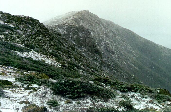
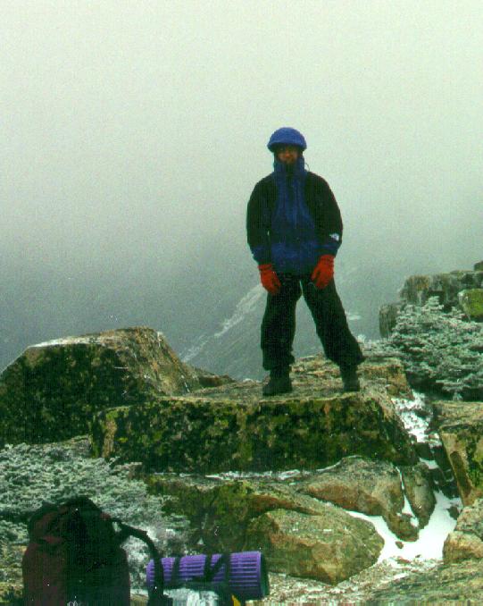
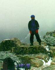 We ascended the last peak into stronger and steadier
winds. A solid 30-40mph blast sailed up the steep cliffs, and even on
the calm leeward side of the ridge, we could feel the turbulence and
the effect of the vortices peeling off the lip of the ravine. At
several points, the trail detoured right to the edge of the slabs,
giving a spectacular view into the deep valley and a cold blast to the
face. The summit itself was a wide, gentle clearing at the top of the
steepest face (right). Here, we found shelter from the wind and
enjoyed a quick lunch. The water in our bottles begin to crystallize,
and within fifteen minutes we noticed a significant drop in
temperature.
We ascended the last peak into stronger and steadier
winds. A solid 30-40mph blast sailed up the steep cliffs, and even on
the calm leeward side of the ridge, we could feel the turbulence and
the effect of the vortices peeling off the lip of the ravine. At
several points, the trail detoured right to the edge of the slabs,
giving a spectacular view into the deep valley and a cold blast to the
face. The summit itself was a wide, gentle clearing at the top of the
steepest face (right). Here, we found shelter from the wind and
enjoyed a quick lunch. The water in our bottles begin to crystallize,
and within fifteen minutes we noticed a significant drop in
temperature.
Getting moving again was difficult. We avoided thinking about the
nine miles or more left to go for the day, hoping to simply achieve a
rhythm and make the miles pass without much thought. Right below the
summit, however, the Bondcliff trail drops off a sheer, 10' ledge. No
big deal, but a thin layer of ice and our heavy packs made it somewhat
unpleasant to attempt. Here, we met several people heading up as part
of a day hike. I wonder how the hell they got their black Lab up that
cliff.
 The Bondcliff trail,
rumored to be a monotonous and annoying exercise, lived up to its
reputation. We descended on nicely graded logging roads for a mile or
two, then began heading south on a nearly flat and featureless
footpath. A mile's detour away from the streambed gave us a little
variety, but this was only the first part of our seven-mile walk
through the woods. After nearly four miles of descent, the
Bondcliff/Wilderness Trail junction was a welcome sight (left).
The Bondcliff trail,
rumored to be a monotonous and annoying exercise, lived up to its
reputation. We descended on nicely graded logging roads for a mile or
two, then began heading south on a nearly flat and featureless
footpath. A mile's detour away from the streambed gave us a little
variety, but this was only the first part of our seven-mile walk
through the woods. After nearly four miles of descent, the
Bondcliff/Wilderness Trail junction was a welcome sight (left). However, the straight and flat Wilderness Trail
(right), reclaimed from a 19th century railroad grade, wasn't much of
a relief. The path was as wide and straight as a two-lane highway,
but old railroad ties made the walking somewhat difficult. Staying to
the edges, we covered the miles quickly, crossing the brooks draining
the Bond peaks, then reaching the major bridge over Lincoln and
Franconia Brook. Wet snow and graupel fell as we sped away along the
last four miles to Lincoln Woods. We arrived at the car tired, damp,
footsore, but still quite satisfied with ourselves. Retrieving the
first car from the Gale River trailhead was a pain, but some beer and
healthy, fresh food at Woodstock Station dulled the pain. Mountain
Dew made the drive home safe and unremarkable.
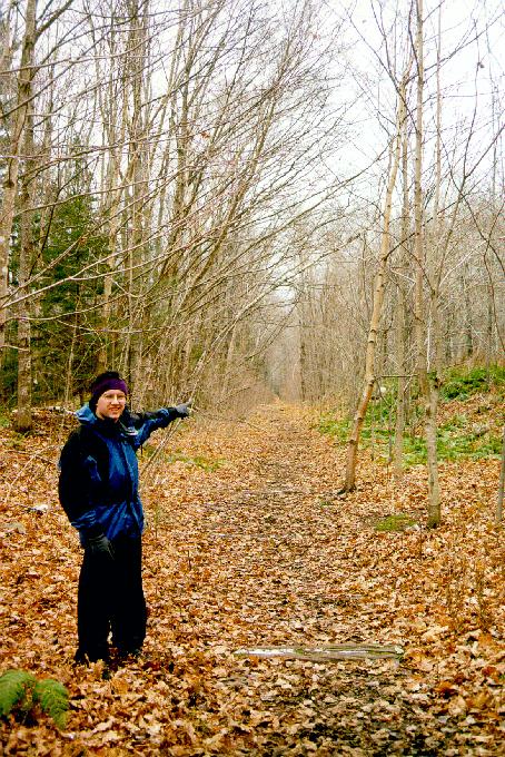
However, the straight and flat Wilderness Trail
(right), reclaimed from a 19th century railroad grade, wasn't much of
a relief. The path was as wide and straight as a two-lane highway,
but old railroad ties made the walking somewhat difficult. Staying to
the edges, we covered the miles quickly, crossing the brooks draining
the Bond peaks, then reaching the major bridge over Lincoln and
Franconia Brook. Wet snow and graupel fell as we sped away along the
last four miles to Lincoln Woods. We arrived at the car tired, damp,
footsore, but still quite satisfied with ourselves. Retrieving the
first car from the Gale River trailhead was a pain, but some beer and
healthy, fresh food at Woodstock Station dulled the pain. Mountain
Dew made the drive home safe and unremarkable.
OK, we didn't do it in one day, or keep going to hit the Hancocks and
Osceolas in some crazy mega-bagging extravaganza. Cool trip,
though.
photos by Matthew Reagan and Paul Rozelle
Back to Outdoor Adventures
 Anyway, October 23
and 24 was the original date, but after gearing up in the face of
positive forecasts, New England got hit by an errant Nor'easter that
dumped rain, freezing rain, and snow across the mountains. We bailed
on the traverse, and instead braved the wet weather to bag North Twin
on the 24th. Not much to see in the clouds, but a fresh coat of wet
snow above 3000' reminded us what season was approaching. More
interesting than the views were the water crossings--the previous
day's 2" of rain had turned "difficult" crossings into "impossible"
ones (right). Bushwacking was mandatory, and one soft stream bank
sent me headfirst into a creek on the way down. Lesson learned:
synthetic clothing does insulate when wet!
Anyway, October 23
and 24 was the original date, but after gearing up in the face of
positive forecasts, New England got hit by an errant Nor'easter that
dumped rain, freezing rain, and snow across the mountains. We bailed
on the traverse, and instead braved the wet weather to bag North Twin
on the 24th. Not much to see in the clouds, but a fresh coat of wet
snow above 3000' reminded us what season was approaching. More
interesting than the views were the water crossings--the previous
day's 2" of rain had turned "difficult" crossings into "impossible"
ones (right). Bushwacking was mandatory, and one soft stream bank
sent me headfirst into a creek on the way down. Lesson learned:
synthetic clothing does insulate when wet!