Into Thin[ner] Air: A Colorado Junket
June 30-July 1, 2000
Hikers: Matthew Reagan, The Octopus
Business travel sucks, usually. You go through all the problems
associated with plane tickets, hotel reservations, car rentals, travel
reimbursement, and the pure anti-joy of the travel itself just to
spend three or four days trapped in some hotel well away from anything
you'd actually like to visit. Atlanta? Dull. Knoxville? Nasty.
Colorado? Hey, now we're talking.
 The excuse for this
pre-thesis vacation was the 14th International Symposium on
Thermophysical Properties. It's held in Boulder, CO (right), which is
a huge improvement over the strip-mall sprawlburban smoghole of
Atlanta that hosted my last big technical event. Even better, the
conference was scheduled over a Monday-Friday block, demanding that at
least one extra weekend be spent in the area to get that
Saturday-night stay discount on the plane ticket. Time to expand my
climbing horizons.
The excuse for this
pre-thesis vacation was the 14th International Symposium on
Thermophysical Properties. It's held in Boulder, CO (right), which is
a huge improvement over the strip-mall sprawlburban smoghole of
Atlanta that hosted my last big technical event. Even better, the
conference was scheduled over a Monday-Friday block, demanding that at
least one extra weekend be spent in the area to get that
Saturday-night stay discount on the plane ticket. Time to expand my
climbing horizons.
 The conference itself
was rather uneventful, with the same faces talking about the same
material I'd heard about at other conferences. My talk was something
new, but I don't think anyone got too excited about it. Whatever--I
had enough to keep me busy. Starting on Tuesday, I began my altitude
training, driving up into the hills around Boulder (8,000'-10,000')
each night after dinner to suck some wind and get used to the
altitude. The weather stayed rainy for the first three days, but on
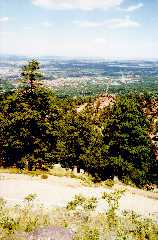
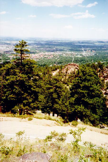
Thursday the sky cleared, allowing me to take an afternoon hike at
6,800' in the Boulder Mountain Park and see the fine views of the city
and of the Front Range (left). The plan was to slowly go higher each
day, with a final attempt on some 14'ers on Saturday.
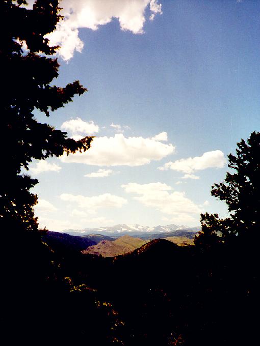
The conference itself
was rather uneventful, with the same faces talking about the same
material I'd heard about at other conferences. My talk was something
new, but I don't think anyone got too excited about it. Whatever--I
had enough to keep me busy. Starting on Tuesday, I began my altitude
training, driving up into the hills around Boulder (8,000'-10,000')
each night after dinner to suck some wind and get used to the
altitude. The weather stayed rainy for the first three days, but on
Thursday the sky cleared, allowing me to take an afternoon hike at
6,800' in the Boulder Mountain Park and see the fine views of the city
and of the Front Range (left). The plan was to slowly go higher each
day, with a final attempt on some 14'ers on Saturday.
 Friday morning dawned
clear and cool--perfect weather for a weekend in the mountains. I
checked out of the (unimpressive) conference facilities at C.U. and
was heading north toward Estes Park by 7am. I paid my $10 admission
and enjoyed breakfast at 9,000' in Rocky Mountain National Park. As I
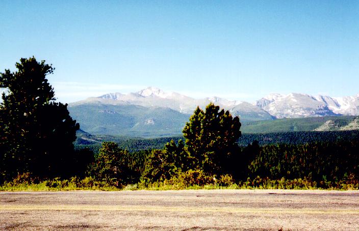
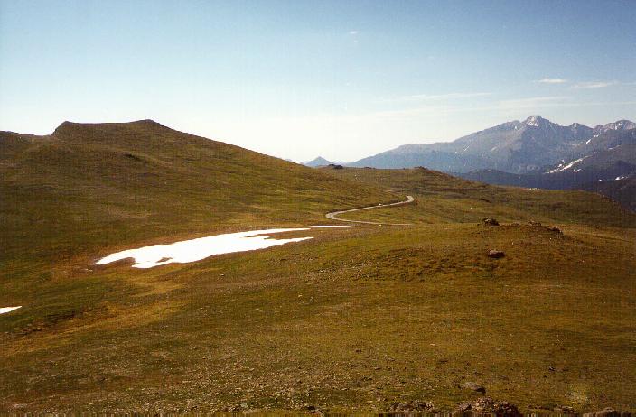
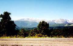
ascended the Trail Ridge Road, views opened up all around, with the
14,255' Long's Peak dominating the park's skyline (right). The road
snakes up and over the highest terrain in the park, topping out at
over 12,000' along the treeless ridge. Each turn offered new views of
mountains I'd never seen before, and after some steep switchbacks the
road carried me and my Avis-rental Cavalier above treeline onto an
endless expanse of alpine tundra (left). I'd seen plenty of tundra
before, and I even recognized many of the plants, but unlike the
precious patches of above-treeline terrain in New England, this stuff
went on forever.
Friday morning dawned
clear and cool--perfect weather for a weekend in the mountains. I
checked out of the (unimpressive) conference facilities at C.U. and
was heading north toward Estes Park by 7am. I paid my $10 admission
and enjoyed breakfast at 9,000' in Rocky Mountain National Park. As I
ascended the Trail Ridge Road, views opened up all around, with the
14,255' Long's Peak dominating the park's skyline (right). The road
snakes up and over the highest terrain in the park, topping out at
over 12,000' along the treeless ridge. Each turn offered new views of
mountains I'd never seen before, and after some steep switchbacks the
road carried me and my Avis-rental Cavalier above treeline onto an
endless expanse of alpine tundra (left). I'd seen plenty of tundra
before, and I even recognized many of the plants, but unlike the
precious patches of above-treeline terrain in New England, this stuff
went on forever. 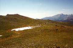 I stopped
at each scenic point, "hiking" along Macadam-paved tourist paths that
kept errant feet off the delicate plantlife. I took a brisk pace on
each excursion, trying to get my heart rate and respiration up for
altitude practice. I did pretty well, feeling better and better about
altitude as the day went on.
I stopped
at each scenic point, "hiking" along Macadam-paved tourist paths that
kept errant feet off the delicate plantlife. I took a brisk pace on
each excursion, trying to get my heart rate and respiration up for
altitude practice. I did pretty well, feeling better and better about
altitude as the day went on.
 I stayed high as long as
possible, even doing a little bit of shopping at the park's Alpine
Visitors Center (11,796'). Beanie Babies and tchochkies over two
miles up--no worse than Mt. Washington, I suppose. After a short
descent to the Continental Divide and Milner Pass (10,758', right), I
took an extended hike, running the two miles back up to treeline on a
hike the park ranger said was over four (OK, looking at the clientele,
I suppose they need to be ultra-conservative). By 1pm, though, it was
time to descend and start my search for a place to spend the night.
I stayed high as long as
possible, even doing a little bit of shopping at the park's Alpine
Visitors Center (11,796'). Beanie Babies and tchochkies over two
miles up--no worse than Mt. Washington, I suppose. After a short
descent to the Continental Divide and Milner Pass (10,758', right), I
took an extended hike, running the two miles back up to treeline on a
hike the park ranger said was over four (OK, looking at the clientele,
I suppose they need to be ultra-conservative). By 1pm, though, it was
time to descend and start my search for a place to spend the night.
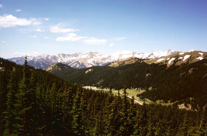
Leaving the park through the western gate, I headed south to US 40
through Winter Park and Berthoud Pass. The "real" Colorado--not the
academic haven of Boulder--stretched out before me. The radio
supplied all the Jesus babble and Country/Western one could ever want,
while flat plains bounded by snow-capped peaks filled the windshield.
Reaching the mountains once again, the resort town of Winter Park
presented a more familiar form of civilization, as well as a nice set
of sculpted ski runs. The highway passed the Winter Park and Mary
Jane ski runs and soon climbed several wicked switchbacks to Berthoud
Pass and the Berthoud Pass Ski Area, supposedly home to excellent
semi-backcountry skiing. A steep descent to I-70 and a few miles of
wading through the holiday traffic brought me to Georgetown and the
road to Guanella Pass.
 A topo map of the
Gray's Peak area revealed a forest service campground a few miles
above Georgetown on Guanella Pass Rd., and since it was only 3pm
Friday, I managed to find an open site. This wasn't as pristine as
the campgrounds I'd seen in the White Mountains--the access road
passed high-tension power lines, a hydroelectric plant, and several
small dams and reservoirs, leading to the campground beside a rough
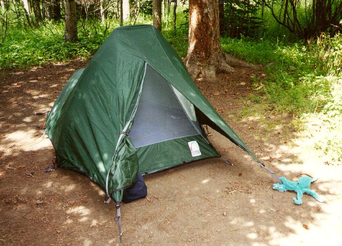
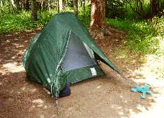
clearing just above 10,000' (left). I set up my "Eclipse" a.k.a. Clip
Flashlight (with some help from The
Octopus) and headed back down to I-70 in search of dinner.
A topo map of the
Gray's Peak area revealed a forest service campground a few miles
above Georgetown on Guanella Pass Rd., and since it was only 3pm
Friday, I managed to find an open site. This wasn't as pristine as
the campgrounds I'd seen in the White Mountains--the access road
passed high-tension power lines, a hydroelectric plant, and several
small dams and reservoirs, leading to the campground beside a rough
clearing just above 10,000' (left). I set up my "Eclipse" a.k.a. Clip
Flashlight (with some help from The
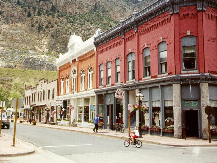
Octopus) and headed back down to I-70 in search of dinner.  Georgetown (right)
turned out to be a nice find, with several touristy but friendly
restaurants on a quaint, restored, Main Street. I drove around a bit
after dinner, checking out the small towns along I-70 and marvelling
at the tremendous volume of traffic heading west out of Denver. Radio
reports indicated that this slow-moving line of SUVs and minivans
ranged over 50 miles, from the Denver suburbs to the Eisenhower
tunnel. And I thought getting to New Hampshire was tough on a holiday
weekend.
Georgetown (right)
turned out to be a nice find, with several touristy but friendly
restaurants on a quaint, restored, Main Street. I drove around a bit
after dinner, checking out the small towns along I-70 and marvelling
at the tremendous volume of traffic heading west out of Denver. Radio
reports indicated that this slow-moving line of SUVs and minivans
ranged over 50 miles, from the Denver suburbs to the Eisenhower
tunnel. And I thought getting to New Hampshire was tough on a holiday
weekend.
I settled in early, after building a small campfire for entertainment
purposes and repacking my gear for the next day's expedition. I
crawled into my tent soon after sunset (quite spacious for one person)
in hope of getting a full night's sleep before sunrise, but I made the
critical error of not checking the altitude of the campsite. At
10,000', sleep was difficult. I'd start to drift off, but as soon as
my breathing began to relax I'd wake up gasping for air. I imagine I
slept a bit over the next eight hours, but only in worthless little
naps. My watch alarm lit up at 5am--and unnecessary alert considering
that I'd been wide awake and watching it since 4:30. A cup of
Whisperlite-brewed Earl Grey made me feel a bit better. I chalk the
night up to "altitude experience."
The drive to the trailhead only took 30 minutes, including the four
miles of rocks, gullies, and potholes that were stuck together to form
an access road (the Cavalier performed superbly, BTW, even passing a
Grand Cherokee SUV owned by a truly incompetent driver who was
completely unaware of wheel placement or "low gear"). The road passed
an interesting assortment of abandoned shacks and newer vacation
cabins, plus one scruffy piece of property surrounded by barbed-wire
fences and numerous "Keep Out"/"No Trespassing"/"Private Property"
signs. The centerpiece of this tangle of barricades was a plywood box
with only one visible window, something like the Unibomber's backwoods
home. Standing proudly on the rickety "porch" (deck? veranda?) was
an even scruffier "gentleman" sporting stringy redneck hair and a
NASCAR T-shirt, and leaning on a large shotgun. I suppose he felt the
need to protect his investment property from the hordes of SUV driving
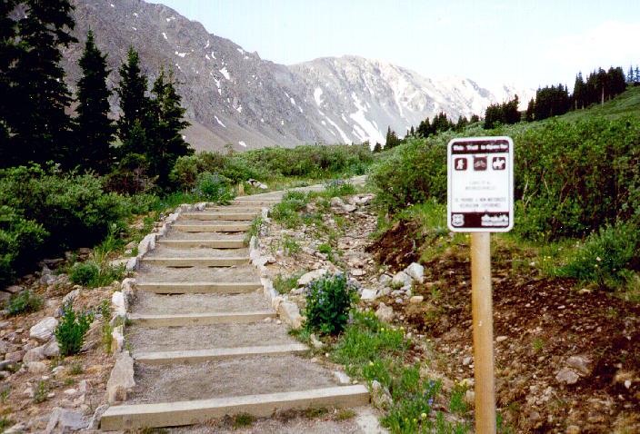
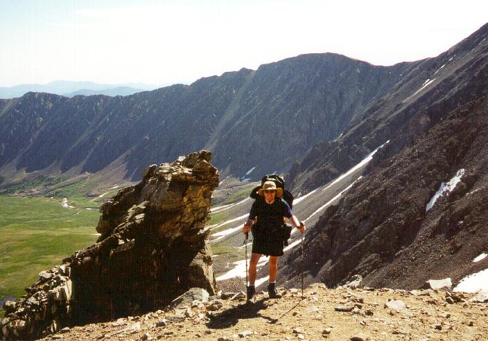
yuppie day-hikers. 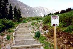 The Gray's
Peak trailhead (11,230'), unlike Bubba's estate, was very well
developed, with restrooms, many signs and posters about "life in the
backcountry," and even a quarter-mile section of gravel-paved trail
for people who just wanted to see a few wildflowers. I snagged one of
the last legal parking spaces at 7am, and was packed and on the trail
(left) by 7:15.
The Gray's
Peak trailhead (11,230'), unlike Bubba's estate, was very well
developed, with restrooms, many signs and posters about "life in the
backcountry," and even a quarter-mile section of gravel-paved trail
for people who just wanted to see a few wildflowers. I snagged one of
the last legal parking spaces at 7am, and was packed and on the trail
(left) by 7:15.
Now, I'd spent some of the previous day walking around above 11,000',
but this was my first time hiking briskly at altitude with a full
pack. I brought all sorts of junk due to this being a solo hike in
unfamiliar territory, and the gear, water, and heavy hiking boots
really made a big difference. I covered the first mile in
ten-minute segments, stopping every time my pace got ahead of my
respiratory rate. Dozens of day-hikers passed, most wearing
all-cotton outfits and carrying tiny packs that barely could have held
two liters of water. I felt somewhat stupid carrying
Presidentials-grade clothing and emergency gear, but considering that
I was a stranger in this country, it was probably a wise thing to
do.
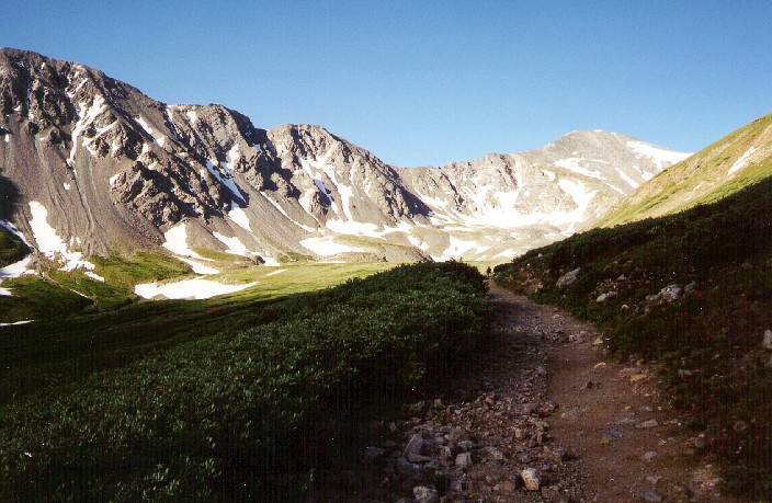
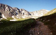 The trail started
out as a gravel-paved nature trail, soon easing into a gentle grade on
a dirt and gravel base. Imagine the lower Tuckerman Ravine
trail--with no rocks! The route gently zigged and zagged through the
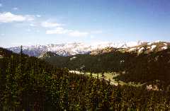
alpine meadows, curving around the base of 13,464' Kelso Mountain and
following a stream that drained a beautiful U-shaped glacial valley
(right).
The trail started
out as a gravel-paved nature trail, soon easing into a gentle grade on
a dirt and gravel base. Imagine the lower Tuckerman Ravine
trail--with no rocks! The route gently zigged and zagged through the
alpine meadows, curving around the base of 13,464' Kelso Mountain and
following a stream that drained a beautiful U-shaped glacial valley
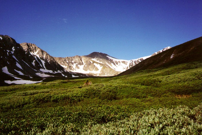
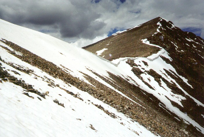
(right). 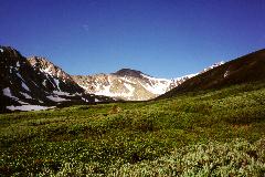 Rounding the first corner,
I finally caught a glimpse of my destination (left), and quickly
regretted leaving my ice axe in the car. A long ridge, lined with
dozens of Huntington-Ravine-esque gullies rose gently to buttress
14,270-foot Gray's Peak. A broad col separated the rounded Gray's
summit from the sharp point of 14,267-foot Torrey's Peak, and the bowl
in between was filled with a huge Tuckerman-style snow bowl topped by
a old, rotten, but still sharply-defined cornice. Glissading
potential was everywhere, but I'd believed the internet reports that
said "all the snow has melted."
Rounding the first corner,
I finally caught a glimpse of my destination (left), and quickly
regretted leaving my ice axe in the car. A long ridge, lined with
dozens of Huntington-Ravine-esque gullies rose gently to buttress
14,270-foot Gray's Peak. A broad col separated the rounded Gray's
summit from the sharp point of 14,267-foot Torrey's Peak, and the bowl
in between was filled with a huge Tuckerman-style snow bowl topped by
a old, rotten, but still sharply-defined cornice. Glissading
potential was everywhere, but I'd believed the internet reports that
said "all the snow has melted."
{You know, one thing I now appreciate more is the
wealth of information available about the White Mountains. Dozens of
people share the details of their hikes on several websites, and you
can always find the information you need about trail conditions,
weather, bugs, and snow. Colorado doesn't seem to have this culture
(Altavista hasn't found it, at least), and what few sites there are
for the 14'ers, the quality of the information is really poor. Do
none of these Western hikers have internet access, or don't they
care?}
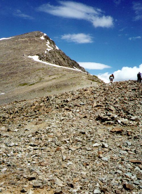
 As the trail approached
the flanks of Gray's, it attacked the steeper grade by looping through
broad, well-constructed switchbacks. At first, I assumed that this
habit of grading the hell out of the trails was simply a function of
wussy Western hikers, but after hitting some of the steeper sections,
it was clear that the intricate construction was necessary for erosion
control. Unlike the New England mountains, where you hike on boulders
from the parking lot to the summit, these mountains were covered by a
loose mix of sandy soil and golf-ball sized stones. The dirt shifted
and slid with each step, despite all the effort made to pave the path
with carefully-placed stones. Acres of alpine wildflowers lined the
sides of the trail--all the more reason to stay on the graded path.
These perfectly graded trails stood out on the neighboring
peaks--looking like minature Mt. Washington Auto Roads switchbacking
up every ridge and summit. Still, a few rock outcrops provided firm
footing and fine photo ops (right).
As the trail approached
the flanks of Gray's, it attacked the steeper grade by looping through
broad, well-constructed switchbacks. At first, I assumed that this
habit of grading the hell out of the trails was simply a function of
wussy Western hikers, but after hitting some of the steeper sections,
it was clear that the intricate construction was necessary for erosion
control. Unlike the New England mountains, where you hike on boulders
from the parking lot to the summit, these mountains were covered by a
loose mix of sandy soil and golf-ball sized stones. The dirt shifted
and slid with each step, despite all the effort made to pave the path
with carefully-placed stones. Acres of alpine wildflowers lined the
sides of the trail--all the more reason to stay on the graded path.
These perfectly graded trails stood out on the neighboring
peaks--looking like minature Mt. Washington Auto Roads switchbacking
up every ridge and summit. Still, a few rock outcrops provided firm
footing and fine photo ops (right).
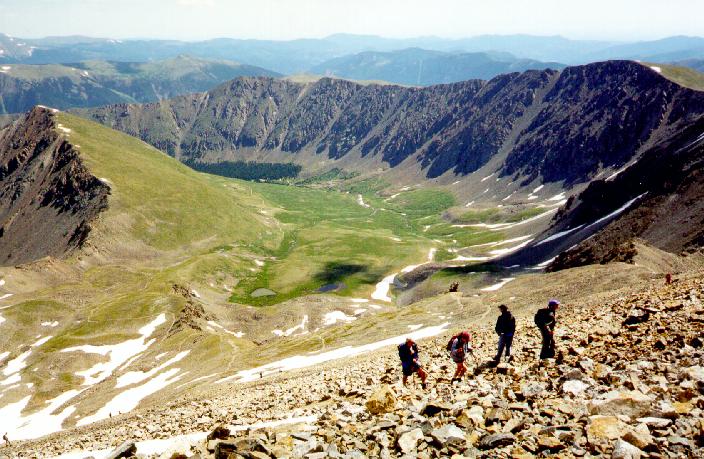
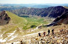 The switchbacks
carried me and the hiking hordes higher and higher, revealing better
and more expansive views with each curve (left). The rough, serrated
Kelso Ridge to Torrey's presented a tempting challenge, and several
steep, snow-filled couloirs begged to be climbed. I stuck to the main
route, however, still sucking wind and feeling somewhat out of my
element. As I approached 13,000' (the highest I'd ever been outside
of an airplane cabin), I had to take a few rest stops to force down
some sugary granola and plenty of water. The last 1,000' feet were
the low point of the day. I hovered at the edge of altitude sickness
without actually getting a headache or feeling nauseous, and soon fell
well behind the two-hour pace listed at the trailhead. The ranger at
RMNP had said that it take two to six weeks to truly acclimatize, and
she was right for once. Stopping for another forced food break
(altitude wrecks your appetite, too), I spent a pleasant ten minutes
chatting with a New England expatriate who shared stories of
Presidential climbs and foul-weather adventures in the Whites. This
seems to have taken my mind off the altitude, because the last 50
yards to the summit weren't a problem even with the
two-pints-on-an-empty-stomach buzz I had going.
The switchbacks
carried me and the hiking hordes higher and higher, revealing better
and more expansive views with each curve (left). The rough, serrated
Kelso Ridge to Torrey's presented a tempting challenge, and several
steep, snow-filled couloirs begged to be climbed. I stuck to the main
route, however, still sucking wind and feeling somewhat out of my
element. As I approached 13,000' (the highest I'd ever been outside
of an airplane cabin), I had to take a few rest stops to force down
some sugary granola and plenty of water. The last 1,000' feet were
the low point of the day. I hovered at the edge of altitude sickness
without actually getting a headache or feeling nauseous, and soon fell
well behind the two-hour pace listed at the trailhead. The ranger at
RMNP had said that it take two to six weeks to truly acclimatize, and
she was right for once. Stopping for another forced food break
(altitude wrecks your appetite, too), I spent a pleasant ten minutes
chatting with a New England expatriate who shared stories of
Presidential climbs and foul-weather adventures in the Whites. This
seems to have taken my mind off the altitude, because the last 50
yards to the summit weren't a problem even with the
two-pints-on-an-empty-stomach buzz I had going.
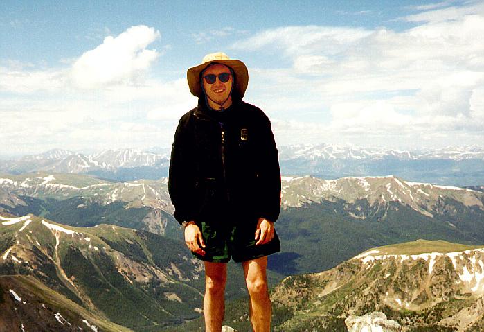
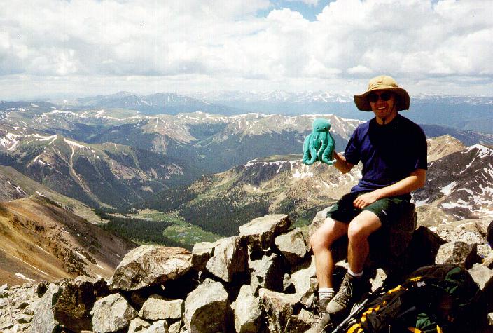
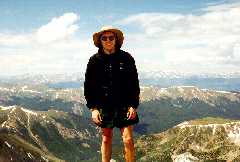 I touched the summit
three hours and thirty minutes after hitting the trail, which
surprisingly matches the standard AMC "book" time for a four mile,
3,000' hike. The views were expansive and awesome, with endless lines
of snowy peaks receding into the distance. I enlisted a fellow hiker
to get me a solo summit photo (right), and brought out The Octopus to commemorate this awesome
occasion. I rested a bit, letting my pulse drop all the way down to
90 beats/minute and relaxing my breathing to the point where I could
talk to people on the summit. I didn't stay long, though, since this
quick recovery moved me to try for a second 14'er.
I touched the summit
three hours and thirty minutes after hitting the trail, which
surprisingly matches the standard AMC "book" time for a four mile,
3,000' hike. The views were expansive and awesome, with endless lines
of snowy peaks receding into the distance. I enlisted a fellow hiker
to get me a solo summit photo (right), and brought out The Octopus to commemorate this awesome
occasion. I rested a bit, letting my pulse drop all the way down to
90 beats/minute and relaxing my breathing to the point where I could
talk to people on the summit. I didn't stay long, though, since this
quick recovery moved me to try for a second 14'er.
 Sick of the dusty
switchbacks, I chose a rockier route to Torrey's--down to the col and
up the connecting ridge along the corniced top edge of the snowfields
(left). I felt a bit more at home walking on rock, but this rock was
still small and loose, like piles of river cobbles rather than the
football- to house-sized boulders that make up a typical Presidential
scramble. I dropped the 300' quickly, and immediately attacked the
steeper ridgeline up to Torrey's. Climbing once again, I was
immediately reminded of the altitude. This 300' scramble was complete
nontrivial, and the loose gravel and small boulders made it even more
of a chore. I seemed have adjusted a bit, though, since I was merely
out of breath, rather than out of my head. Determined to finish the
job, I gasped and stumbled up to the sharp summit of Torrey's Peak,
arriving a little less than an hour after leaving Gray's.
Sick of the dusty
switchbacks, I chose a rockier route to Torrey's--down to the col and
up the connecting ridge along the corniced top edge of the snowfields
(left). I felt a bit more at home walking on rock, but this rock was
still small and loose, like piles of river cobbles rather than the
football- to house-sized boulders that make up a typical Presidential
scramble. I dropped the 300' quickly, and immediately attacked the
steeper ridgeline up to Torrey's. Climbing once again, I was
immediately reminded of the altitude. This 300' scramble was complete
nontrivial, and the loose gravel and small boulders made it even more
of a chore. I seemed have adjusted a bit, though, since I was merely
out of breath, rather than out of my head. Determined to finish the
job, I gasped and stumbled up to the sharp summit of Torrey's Peak,
arriving a little less than an hour after leaving Gray's.
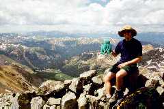 I stopped for
another set of sweeping views and Octopus
conquests (right), and noticed the gray plastic tube containing
the summit register. Doh! I could have "officially" signed in
on Gray's, too! I signed in for both myself and The Octopus, making a note of all the
religious graffiti the locals placed in the register. About one in
four entries had some kind of proselytizing, from "Jesus Loves You!"
(how nice) to "Bow down before Him or BURN in hell!!!!!!" (how
nice) to one entry that suggested that Jesus H. Christ himself had
climbed the peak (now that would impress me). I felt the need
to leave something profound, as well as respond to all the god-talk,
so in a high-altitude haze I added my own perspective:
I stopped for
another set of sweeping views and Octopus
conquests (right), and noticed the gray plastic tube containing
the summit register. Doh! I could have "officially" signed in
on Gray's, too! I signed in for both myself and The Octopus, making a note of all the
religious graffiti the locals placed in the register. About one in
four entries had some kind of proselytizing, from "Jesus Loves You!"
(how nice) to "Bow down before Him or BURN in hell!!!!!!" (how
nice) to one entry that suggested that Jesus H. Christ himself had
climbed the peak (now that would impress me). I felt the need
to leave something profound, as well as respond to all the god-talk,
so in a high-altitude haze I added my own perspective:
Don't waste your time on 2,000 year old superstition.
Salvation is right here. Look around.
It seemed profound at the time.
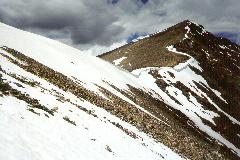 I spent only
fifteen minutes on the summit. By noon, the puffy cumulus clouds
surrounding the peaks seemed to be getting larger, and I felt a sudden
urgency. I blasted down the ridge, balancing on the loose rock with
my trusty poles, traversed across the top edge of the wide snowfield
(looking down, sadly, at 1,000' of perfect steep glissading!), and
rejoined the Gray's Peak Trail just above the first set of
switchbacks. I was amazed at the number of people who cut onto the
snowfield much higher up on Torrey's, walking along the edge of that
old cornice (left). I assume they hadn't scoped out the route from
below, and didn't realize they were standing on an undermined ledge of
old snow above 1,500' of steep slush and boulders. For me, the air
below 13,000' seemed positively thick, and I flew down the
trail using my poles for balance and slow, late, altitude-sick
day-hikers as slalom gates.
I spent only
fifteen minutes on the summit. By noon, the puffy cumulus clouds
surrounding the peaks seemed to be getting larger, and I felt a sudden
urgency. I blasted down the ridge, balancing on the loose rock with
my trusty poles, traversed across the top edge of the wide snowfield
(looking down, sadly, at 1,000' of perfect steep glissading!), and
rejoined the Gray's Peak Trail just above the first set of
switchbacks. I was amazed at the number of people who cut onto the
snowfield much higher up on Torrey's, walking along the edge of that
old cornice (left). I assume they hadn't scoped out the route from
below, and didn't realize they were standing on an undermined ledge of
old snow above 1,500' of steep slush and boulders. For me, the air
below 13,000' seemed positively thick, and I flew down the
trail using my poles for balance and slow, late, altitude-sick
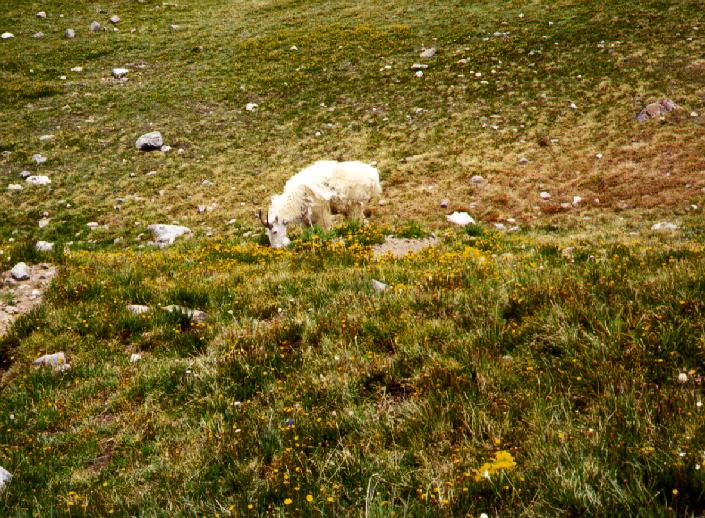
day-hikers as slalom gates. 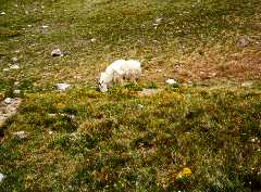 Around the base of Kelso Mtn., I ran smack into a herd
of bored-looking mountain goats (right). They gladly posed for
pictures in between lazy munches on tundra plantlife.
Around the base of Kelso Mtn., I ran smack into a herd
of bored-looking mountain goats (right). They gladly posed for
pictures in between lazy munches on tundra plantlife.
Light sprinkles began to fall as misty clouds billowed up through the
Gray's-Torrey's col. As I trotted down the two-mile runout, I looked
back to see dozens of people silhouetted against an angry sky,
including several people who still seemed to be ascending the
switchbacks. Thunder rumbled in the distance, and distant
thunderheads grew upward from the hot and smoggy valleys. These folks
are lucky to have typically predictable and benevolent weather--this
sort of behavior has killed dozens of people on Mt. Washington
alone.
I arrived back at the car around 1:45 and hit the "high-clearance"
road again by 2pm. A nasty headache appeared out of nowhere as I
dropped below 10,000', and a liter of Gatorade did nothing to fix it.
I worried about altitude once more, then realized the real problem and
stopped for a bottle of iced tea in Idaho Springs. Aahh, caffiene!
Saturday night was spent in a Motel
6 in a dingier part of dingy Denver, but capped by a fine dinner
at the Wazee Supper Club in "LoDo" (the small upscale district in
downtown Denver). I slept very well that night.
All my travel troubles have given me two domestic plane tickets.
Where to next?
Photos by Matthew Reagan
Back to Outdoor Adventures
 The excuse for this
pre-thesis vacation was the 14th International Symposium on
Thermophysical Properties. It's held in Boulder, CO (right), which is
a huge improvement over the strip-mall sprawlburban smoghole of
Atlanta that hosted my last big technical event. Even better, the
conference was scheduled over a Monday-Friday block, demanding that at
least one extra weekend be spent in the area to get that
Saturday-night stay discount on the plane ticket. Time to expand my
climbing horizons.
The excuse for this
pre-thesis vacation was the 14th International Symposium on
Thermophysical Properties. It's held in Boulder, CO (right), which is
a huge improvement over the strip-mall sprawlburban smoghole of
Atlanta that hosted my last big technical event. Even better, the
conference was scheduled over a Monday-Friday block, demanding that at
least one extra weekend be spent in the area to get that
Saturday-night stay discount on the plane ticket. Time to expand my
climbing horizons.