Mt. Jefferson via the Ridge of the Caps
July 26, 1998
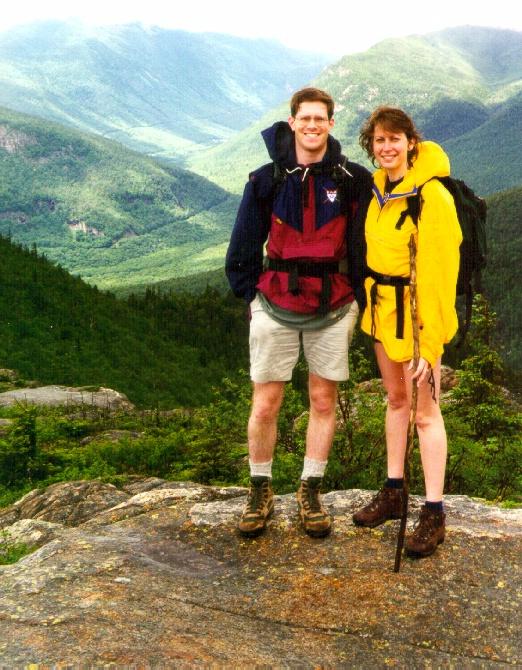
Hikers: Matthew Reagan, Paul and Susan Rozelle, a nice family from
Worcester, and The Octopus
Even if one has done all of the Presidentials, there are still
plenty of reasons to go back. No where else in the Northeast will you
find such a vast expanse of fascinating and impressive terrain. So,
when someone asks where they can do a nice climb, the choice is
obvious.
A spring climb up Mt. Flume got
Paul interested in the local hiking scene during his summer stay in
the Boston area, and his apparently glowing reports about White
Mountain vistas convinced Susan to come along on the next trip. We
made an attempt at the Presidentials on July 11, but near-freezing
summit temperatures and a persistant drizzle pushed us away from the
alpine zone and down to a short hike up to Mt. Crawford (via the Davis
Path). Despite the dreary weather, we got some fantastic
mist-shrouded views of Crawford
Notch and a good practice hike for bigger things to come. Two
weeks later, the rainy spell had passed, a heat wave had come and
gone, and the skies were unusually clear.
 Our day began at the height of land on Jefferson Notch
road (3009'). Thanks to this road, we were able to skip
1,000-1,500 feet and 1-2 miles of hiking and still make it above
treeline. After loading up on water and DEET, and after securing The
(well-travelled) Octopus, we were
approached by a nice family from Worcester who had heard that this was
the "easiest" route up to a Presidential summit and wanted to make it
to Jefferson
by lunch. I was characteristically cautious in making
recommendations, but they decided to try it anyway. We then had
company for the first half of the hike.
Our day began at the height of land on Jefferson Notch
road (3009'). Thanks to this road, we were able to skip
1,000-1,500 feet and 1-2 miles of hiking and still make it above
treeline. After loading up on water and DEET, and after securing The
(well-travelled) Octopus, we were
approached by a nice family from Worcester who had heard that this was
the "easiest" route up to a Presidential summit and wanted to make it
to Jefferson
by lunch. I was characteristically cautious in making
recommendations, but they decided to try it anyway. We then had
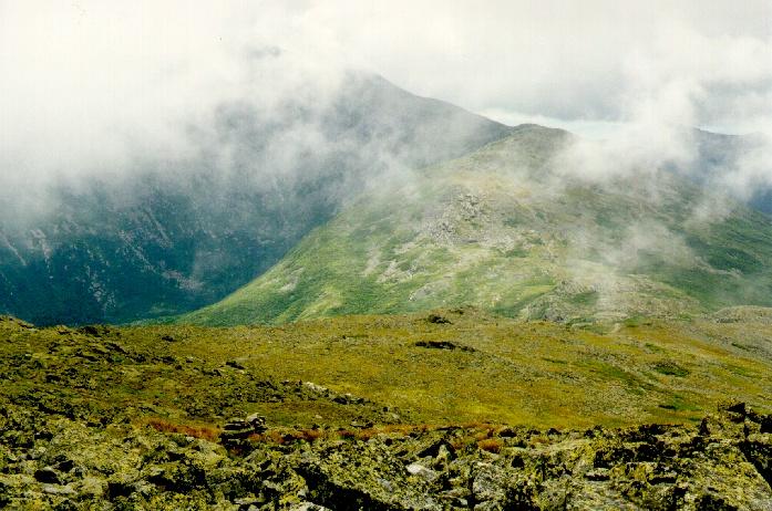
company for the first half of the hike. 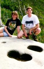 The trail begins in a flat, swampy area in the notch,
and then quickly climbs steadily through the woods with good footing
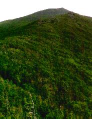
and even grades. With "our" family close behind, we covered the first
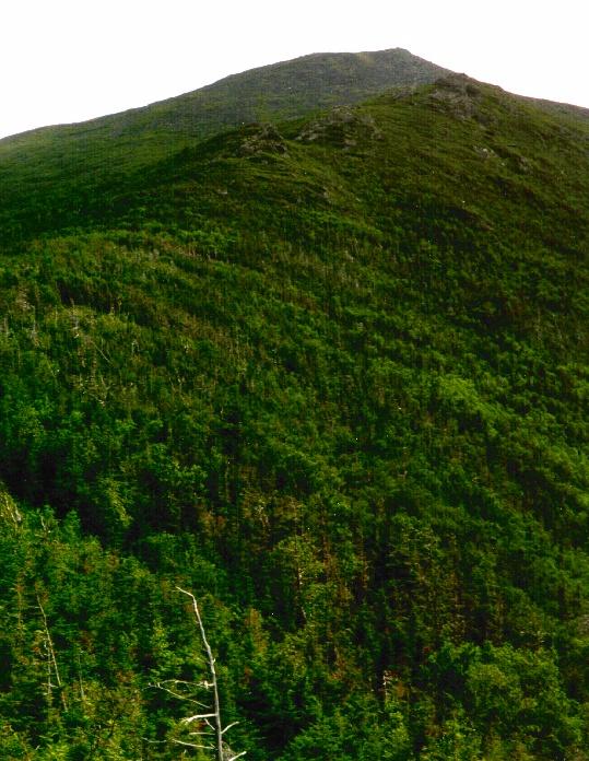
mile in a textbook hour and reached the first views of our destination
as the ridge began to narrow (right). From this ledge we also got a
fine view of Jefferson, Clay, and the Southern Presidentials, with
Washington still rising into the clouds. The ledge included a notable
geological formation--potholes formed by running water (left).
Considering that we were already at a relatively high point on the
ridge, it was interesting to imagine the waterfall that must have
cascaded down off the melting continental ice sheet 13,000 years
ago.
The trail begins in a flat, swampy area in the notch,
and then quickly climbs steadily through the woods with good footing
and even grades. With "our" family close behind, we covered the first
mile in a textbook hour and reached the first views of our destination
as the ridge began to narrow (right). From this ledge we also got a
fine view of Jefferson, Clay, and the Southern Presidentials, with
Washington still rising into the clouds. The ledge included a notable
geological formation--potholes formed by running water (left).
Considering that we were already at a relatively high point on the
ridge, it was interesting to imagine the waterfall that must have
cascaded down off the melting continental ice sheet 13,000 years
ago.
 After a leisurely break, we proceeded into the scrub
and up the ever-narrowing ridge. The Nice Family was waiting for us
up ahead (I must have looked like I knew what I was doing) and again
followed us toward the first Cap.
After a leisurely break, we proceeded into the scrub
and up the ever-narrowing ridge. The Nice Family was waiting for us
up ahead (I must have looked like I knew what I was doing) and again
followed us toward the first Cap.
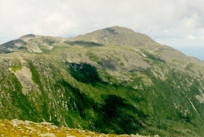
Then, things got interesting. A break in the trees revealed the first
Cap looming steeply above us. The trail began to climb, first on
steep rock steps, then on steeper rock slabs (right). Susan, who was
specifically looking to get to know the mountains better, proclaimed
the terrain "cool." The family disappeared--apparently they did
not care to get so up-close-and-personal with the mountain.
The steep climb soon brought us out into the open at the base of the
Cap. From here, several routes presented themselves. The blazes, and
a well-trodden footpath, led around and below the steepest ledges.
However, numerous handholds allowed a more direct route to the top.
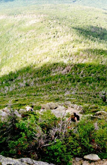
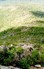 From here, the ridge was completely exposed and above
treeline. A look back showed the short distance covered, and the
steepness of the ridge (left).
From here, the ridge was completely exposed and above
treeline. A look back showed the short distance covered, and the
steepness of the ridge (left).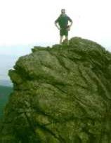 The trail climbed over
several smaller features, and then ascended steeply to the upper Cap
(right), with more ledge walking and scrambles. Above this point, the
ridge blended into the main mountain mass, and the remaining 700' of
vertical was simply a long uphill slog through a sea of broken rock.
This was not nearly as "cool" as the ridge climbs, but once you get
this far you want to make it to the top.
The trail climbed over
several smaller features, and then ascended steeply to the upper Cap
(right), with more ledge walking and scrambles. Above this point, the
ridge blended into the main mountain mass, and the remaining 700' of
vertical was simply a long uphill slog through a sea of broken rock.
This was not nearly as "cool" as the ridge climbs, but once you get
this far you want to make it to the top.
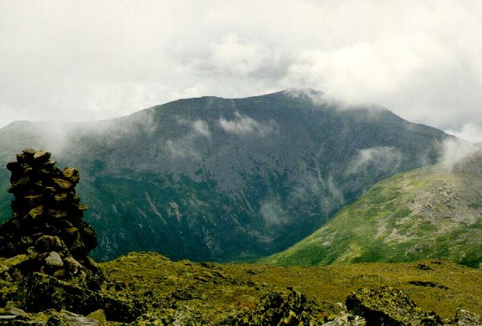
After a final sprint to the highest of the three summits, we settled
down on the eastern slope of the summit cone to enjoy a well earned
lunch. Goldfish and M&M's were in abundance. So were views--of the
Monticello Lawn and Sphinx Col (left), and of Mt. Washington across
the Great Gulf (right). The temperature was perfectly seasonable (in
the low 50's), and a steady breeze blew streams of mist across the
alpine terrain. 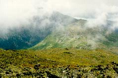
 We enjoyed a fine air show as a sailplane took
advantage of the airflow across the ridge, silently soaring only a few
dozen feet over our heads.
We enjoyed a fine air show as a sailplane took
advantage of the airflow across the ridge, silently soaring only a few
dozen feet over our heads.
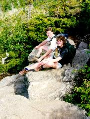
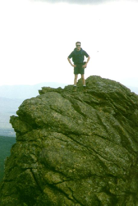
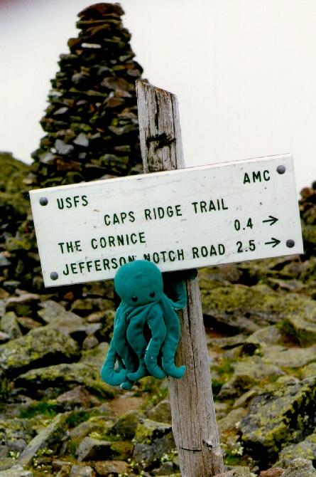
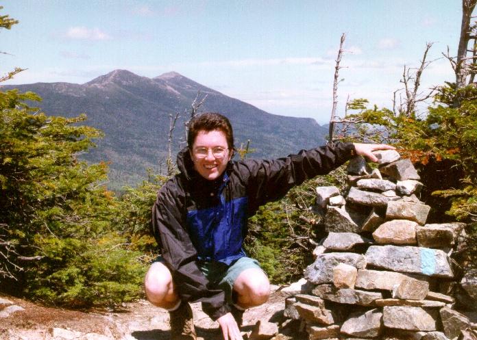
Once fed and hydrated, we stopped for the obligatory summit photo
(left,below), with the proud Octopus
claiming Mt. Jefferson for eight-legged creatures everywhere. To
avoid a steep and rocky descent down the summit cone, we instead
detoured north to the Gulfside Trail, enjoying the better footing and
scenic vistas of Mt. Adams, Jefferson Ravine, and the Great Gulf
(right). Turning east and then south on the Gulfside, we followed the
line of quartz-topped cairns along a level path in the lee of the
Jefferson summit. Mt. Washington loomed silently over the headwall of
the Gulf, and darker, thicker 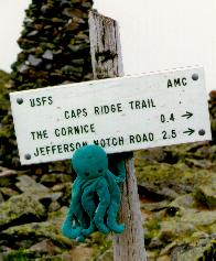 clouds appeared over the
ridge.
clouds appeared over the
ridge. 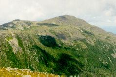 We soon completed the
loop and crossed the Monticello Lawn, where the wind had picked up
considerably and the streams of mist had grown up to become full-sized
and fast-moving clouds. We descended from the lawn via the Cornice,
connected to the Caps Ridge Trail below the summit cone, and retraced
our path over the Caps and down the ridge.
We soon completed the
loop and crossed the Monticello Lawn, where the wind had picked up
considerably and the streams of mist had grown up to become full-sized
and fast-moving clouds. We descended from the lawn via the Cornice,
connected to the Caps Ridge Trail below the summit cone, and retraced
our path over the Caps and down the ridge.
The descent was not as difficult as the climb up would have suggested.
Susan discovered the wonders of the denim-reinforced butt-slide, while
I decided to again take the hard way down (and up and down). With a
quick stop at the potholes to reapply DEET, we moved quickly down the
ridge and made it back to the car in a mere 1.5 hours.
Dinner at Woodstock Station, of course!
photos by Matthew Reagan
Back to Outdoor
Adventures
 Our day began at the height of land on Jefferson Notch
road (3009'). Thanks to this road, we were able to skip
1,000-1,500 feet and 1-2 miles of hiking and still make it above
treeline. After loading up on water and DEET, and after securing The
(well-travelled) Octopus, we were
approached by a nice family from Worcester who had heard that this was
the "easiest" route up to a Presidential summit and wanted to make it
to Jefferson
by lunch. I was characteristically cautious in making
recommendations, but they decided to try it anyway. We then had
company for the first half of the hike.
Our day began at the height of land on Jefferson Notch
road (3009'). Thanks to this road, we were able to skip
1,000-1,500 feet and 1-2 miles of hiking and still make it above
treeline. After loading up on water and DEET, and after securing The
(well-travelled) Octopus, we were
approached by a nice family from Worcester who had heard that this was
the "easiest" route up to a Presidential summit and wanted to make it
to Jefferson
by lunch. I was characteristically cautious in making
recommendations, but they decided to try it anyway. We then had
company for the first half of the hike.  The trail begins in a flat, swampy area in the notch,
and then quickly climbs steadily through the woods with good footing
and even grades. With "our" family close behind, we covered the first
mile in a textbook hour and reached the first views of our destination
as the ridge began to narrow (right). From this ledge we also got a
fine view of Jefferson, Clay, and the Southern Presidentials, with
Washington still rising into the clouds. The ledge included a notable
geological formation--potholes formed by running water (left).
Considering that we were already at a relatively high point on the
ridge, it was interesting to imagine the waterfall that must have
cascaded down off the melting continental ice sheet 13,000 years
ago.
The trail begins in a flat, swampy area in the notch,
and then quickly climbs steadily through the woods with good footing
and even grades. With "our" family close behind, we covered the first
mile in a textbook hour and reached the first views of our destination
as the ridge began to narrow (right). From this ledge we also got a
fine view of Jefferson, Clay, and the Southern Presidentials, with
Washington still rising into the clouds. The ledge included a notable
geological formation--potholes formed by running water (left).
Considering that we were already at a relatively high point on the
ridge, it was interesting to imagine the waterfall that must have
cascaded down off the melting continental ice sheet 13,000 years
ago.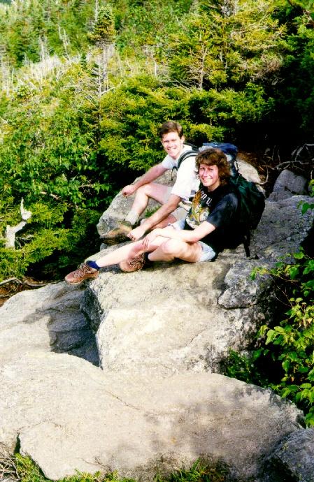