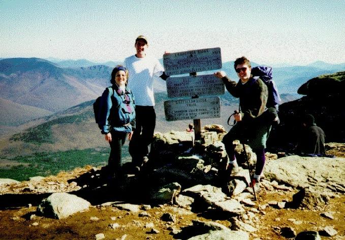
Hikers: Matthew Reagan, Randy Weinstein, Laurie Nazzaro
A classic New Hampshire day hike! Franconia Ridge is
one of the must-do hikes for anyone who wants to get out and see the
White Mtns. The trip is only moderately strenuous and the views are
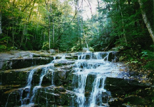
fantastic. Too bad the ridge can be so crowded.The hike begins at the Lafayette Place parking area off US 3 (Franconia Notch Parkway). The Falling Waters Trail starts out as a nice woodland walk, passing over a well-graded path that winds its way toward the slopes of Little Haystack Mtn. The grade steepens slowly as you pass the first of several scenic cascades (first photo -- click on a photo to see a full-sized version). Some of the falls require that you get your feet wet (or walk carefully, depending on the recent rainfall) as the trail winds back and forth across the stream during the ascent. Eventually, the trail turns right and begins to zig-zag up an old logging grade. The steepness increases throughout the boreal forest zone, then the trail finally climbs straight up through the scrub to the summit of Little Haystack, where it meets the Franconia Ridge Trail.
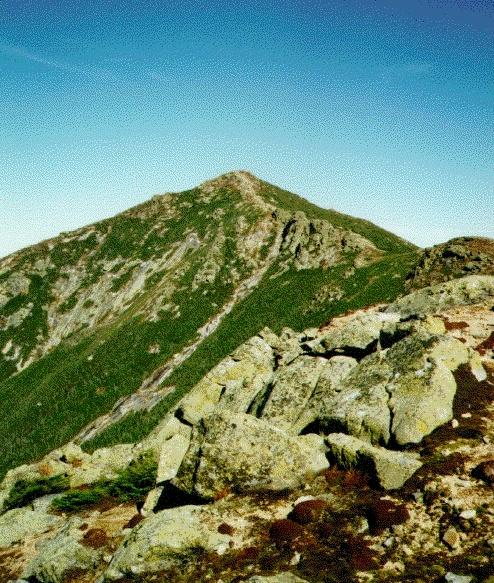 From Little Haystack you get a 360' panorama of the
Notch, the peaks south along the ridge, and Mt. Lincoln (second
photo). You also usually encounter the first serious traffic at this
popular lunch spot. The trail heads north along the exposed
knife-edge, with impressive drops and impressive views on either side.
To the east is the western lobe of the Pemigewasset Wilderness, with
views of Owl's Head, Guyot and Bond, and the Twin-Zealand ridge.
Mt. Washington and the Presidentials loom in the distance, with an
occasional puffs of black smoke from the cog railway. The ridge walk
is great on a sunny day, but should be attempted with caution when
wind or foul weather threatens since there is only limited shelter in
the occasional patches of scrub.
From Little Haystack you get a 360' panorama of the
Notch, the peaks south along the ridge, and Mt. Lincoln (second
photo). You also usually encounter the first serious traffic at this
popular lunch spot. The trail heads north along the exposed
knife-edge, with impressive drops and impressive views on either side.
To the east is the western lobe of the Pemigewasset Wilderness, with
views of Owl's Head, Guyot and Bond, and the Twin-Zealand ridge.
Mt. Washington and the Presidentials loom in the distance, with an
occasional puffs of black smoke from the cog railway. The ridge walk
is great on a sunny day, but should be attempted with caution when
wind or foul weather threatens since there is only limited shelter in
the occasional patches of scrub.
After ascending to the summit of Lincoln, the trail drops into a more serious col on its way to Lafayette, passing several interesting rock formations along the way and an excellent view of the cliffs of Cannon Mtn. across the Notch. The summit of Lafayette sits at 5260', with excellent views all around the Whites.
 The Old Bridal Path leaves the summit heading west
down an exposed, rock-strewn slope. Although it was only late
October, we found quite a bit of ice crusted on the western slopes of
Lafayette. The trail descends steeply with somewhat rough footing
down to a broad shoulder, on which is the AMC Greenleaf Hut. From the
hut, the trail heads west and down into a small sag before following
the ridge line west and south away from Lafayette. The trail descends
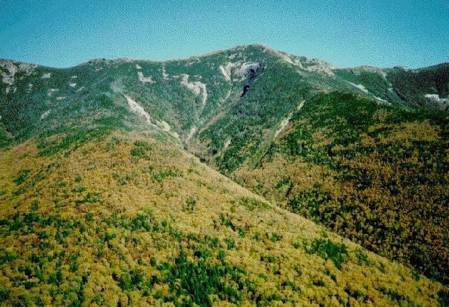
first along the top and then along the east side of the ridge, passing
down the steep "Agonies" with excellent views back to Lincoln over
Walker Ravine (third photo), and over the Notch to Cannon, Kinsman,
and Moosilauke. The trail passes several more outlooks into the
ravine, then turns right and descends into the forest on its way back
to Lafayette Place.
The Old Bridal Path leaves the summit heading west
down an exposed, rock-strewn slope. Although it was only late
October, we found quite a bit of ice crusted on the western slopes of
Lafayette. The trail descends steeply with somewhat rough footing
down to a broad shoulder, on which is the AMC Greenleaf Hut. From the
hut, the trail heads west and down into a small sag before following
the ridge line west and south away from Lafayette. The trail descends
first along the top and then along the east side of the ridge, passing
down the steep "Agonies" with excellent views back to Lincoln over
Walker Ravine (third photo), and over the Notch to Cannon, Kinsman,
and Moosilauke. The trail passes several more outlooks into the
ravine, then turns right and descends into the forest on its way back
to Lafayette Place.
The brewpub at Woodstock Station in North Woodstock is a great place to stop on the way back home. Try the stouts.
photos by Randy Weinstein
| Home | Leave a comment |