A Road Trip Across the USA
February/March 2001
Driver: Matthew Reagan
As described in other sections of this web page, in February of 2001 I
finally realized that it was time to move. Not that I wasn't happy
living in Boston, and not that I was restless and felt the need to try
something different, but career-wise it was time to move on, if only
for a few years. To make the best of the situation, I decided to
approach it as an adventure. I had a new, highway-worthy car, the
promise of a real paycheck, and about ten days to make the trip. I
had recently read Bill Bryson's I'm a Stranger Here Myself and
The Lost Continent, and I had some idea what I was in for.
Having been raised in the urban Northeast and having lived in cities
all my life, I expected America to be a bit of a cultural adventure.
Yes, it was.
The trip started immediately after the movers left Westland Av. It
was late afternoon, my half of the apartment was empty, and a terrible
realization came over me--it was time to go. Rather then drag out the
process and have to deal with the thought of leaving home for a
few years, if not for good, I got my driving underway as soon as
possible. In retrospect, this wasn't a great idea. It did
keep me from getting too sentimental about things, but I was driving
south into a coastal snowstorm.
It wasn't my driving I was worried about. With a new car
full of safety features like antilock brakes and traction control, my
extensive foul-weather driving skills were more than enough to deal
with a few inches of slush. As usual, however, the driving skill of
others were not up to the same standard. I hit my first trouble on
the Hutchinson Parkway in NY. I cruised along safely at 40mph, while
dozens of cars sped by, only to slip and slide at the next sharp turn.
I gave up on the Parkways and headed north and west on I-287, hoping
to get away from the coast and away from the heaviest snow. I did get
away, but the cumulative effects of the rush-hour dump had paralized
the greater NYC area. Traffic blocked the plows, which allowed snow
to accumulate, which caused cars to get stuck, which blocked further
access for plows. Stick a fork in us--we're done. I spent the night
in an overpriced hotel room in Suffern, NY (or some other upstate
suburb).
The next day dawned clear and sunny, and I was on the road by 6am and
home in Allentown, PA a little after eight. I spent a few days in
Allentown to say goodbye to my family, then drove down to Philadelphia
to say goodbye to another dear friend. Then, with all the goodbyes
said and the car packed, I headed west on the Pennsylvania Turnpike.
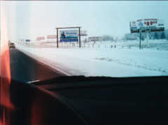
Somewhere near Harrisburg, a billboard advertised:
San Francisco: 2796 miles
It was referring to some sort of truck stop, but the clear statement
of my goal was entirely appropriate. I made it to Wheeling, WV that
night and stayed in a nice hotel just behind the rocky ridge that
bounds the Ohio River. The downtown area seemed nice enough as I
cruised though looking for possible food and drink, but the friendly
hotel staff suggested that I avoid returning. "They don't like folks
from out of town," I was told, and all the riverfront glitter covered
a fairly seedy and dangerous neighborhood. Sigh. We're not in
Boston anymore, are we?
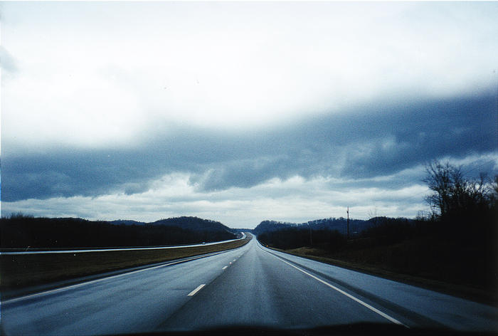
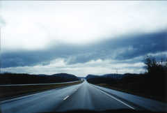 Over night, some rain moved in, washing the
accumulated grime off my still-unblemished car. I hit the road at
6am, and drove over the Ohio River into Ohio the State just as the sky
began to clear (right). So began a long and tedious day of
driving.
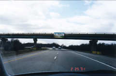
Over night, some rain moved in, washing the
accumulated grime off my still-unblemished car. I hit the road at
6am, and drove over the Ohio River into Ohio the State just as the sky
began to clear (right). So began a long and tedious day of
driving.
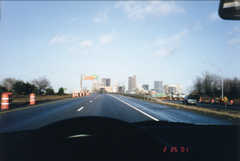 I reached Columbus in
the clear light of a beautiful Sunday morning (left). While stopping
for gas, I searched for my typical truck stop refreshment of tea with
milk and sugar. Here, in Columbus, culture shock first hit me. They
had tea, although it was that orange Lipton stuff. They had sugar, of
course, but there was no milk dispenser. Hell, there wasn't even a
bin of those half-n-half shots. All I found was a three-tiered bin of
paper packets--filled with something called "whitener." Why would I
want that in my tea? It was either acidic Lipton or "whitened"
Lipton, so I dissolved some of the lumpy power into my hot drink.
Now, I began to miss home. All of the Irving gas stations I once
frequented always had nice fresh milk taps and a choice of teas like
English Breakfast or Earl Grey. Out here in middle America, they just
had whitener. What the hell do they use all those cows for if they
can't offer a visitor some decent dairy products? The clerk at the
counter, seeing my confusion, gave me the tea for free. Bill Bryson
was right, people out here are friendly and good-natured--in a bovine
sort of way.
I reached Columbus in
the clear light of a beautiful Sunday morning (left). While stopping
for gas, I searched for my typical truck stop refreshment of tea with
milk and sugar. Here, in Columbus, culture shock first hit me. They
had tea, although it was that orange Lipton stuff. They had sugar, of
course, but there was no milk dispenser. Hell, there wasn't even a
bin of those half-n-half shots. All I found was a three-tiered bin of
paper packets--filled with something called "whitener." Why would I
want that in my tea? It was either acidic Lipton or "whitened"
Lipton, so I dissolved some of the lumpy power into my hot drink.
Now, I began to miss home. All of the Irving gas stations I once
frequented always had nice fresh milk taps and a choice of teas like
English Breakfast or Earl Grey. Out here in middle America, they just
had whitener. What the hell do they use all those cows for if they
can't offer a visitor some decent dairy products? The clerk at the
counter, seeing my confusion, gave me the tea for free. Bill Bryson
was right, people out here are friendly and good-natured--in a bovine
sort of way.
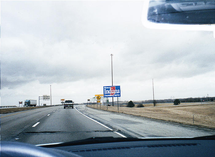
 Ohio melted away into
a monotonous blur of rolling hills and waving grass. Then came
Indiana (right), which made Ohio seem much more interesting. It was
an endless parade of grass, billboards, farming paraphenalia, and the
occasional stand of trees. Pretty, yes, but not enough to break the
monotony of the drive or to provide landmarks or measures of
progress.
Ohio melted away into
a monotonous blur of rolling hills and waving grass. Then came
Indiana (right), which made Ohio seem much more interesting. It was
an endless parade of grass, billboards, farming paraphenalia, and the
occasional stand of trees. Pretty, yes, but not enough to break the
monotony of the drive or to provide landmarks or measures of
progress.
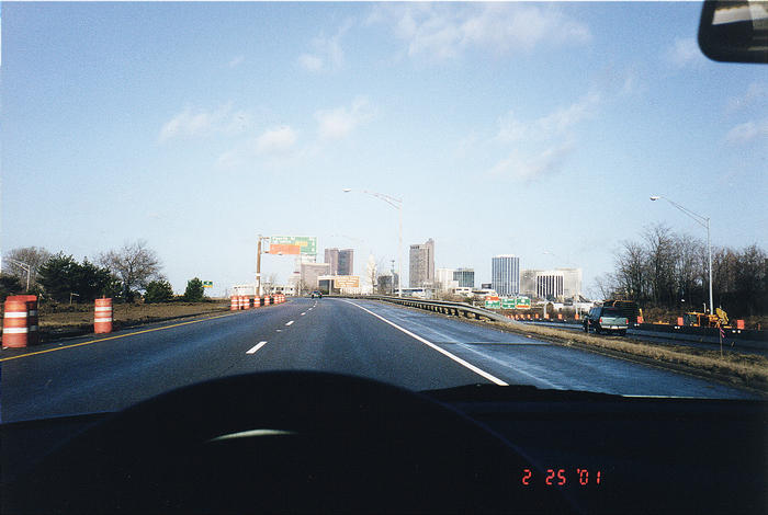
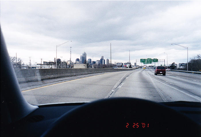
 Indiana soon gave
me Indianapolis (left). Out of the flattening midwestern plains, the
tall buildings and variety of radio stations were an oasis. Of course,
most of the radio stations played country and western, but I
soon found my lifeline: NPR. As the cultural landmarks I knew so well
disappeared behind me, the voice of NPR kept me connected with the
world of the Liberal Cultural Elite. I was impressed that the
reception out here was more consistent than anything I'd found back
home.
Indiana soon gave
me Indianapolis (left). Out of the flattening midwestern plains, the
tall buildings and variety of radio stations were an oasis. Of course,
most of the radio stations played country and western, but I
soon found my lifeline: NPR. As the cultural landmarks I knew so well
disappeared behind me, the voice of NPR kept me connected with the
world of the Liberal Cultural Elite. I was impressed that the
reception out here was more consistent than anything I'd found back
home.
As for Indianapolis, it looked like most newer American cities: a
high-rise core, surrounded by industrial wasteland and urban blight,
wrapped tightly by a belt highway, with more affluent suburbs all
around. People seem to like this sort of thing. I don't know why.
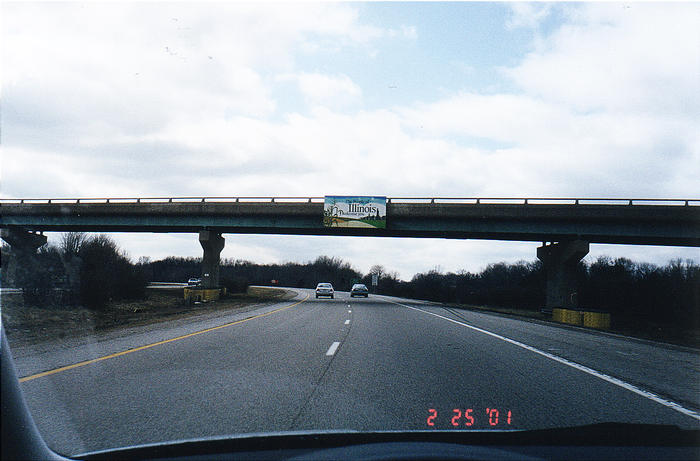
 West of Indianapolis,
the flat plains of the Midwest swallowed me completely. Crossing into
Illinois (right) provided a landmark, but nothing to see, really. It
was some time before I was coughed up on the shores of the
Mississippi.
West of Indianapolis,
the flat plains of the Midwest swallowed me completely. Crossing into
Illinois (right) provided a landmark, but nothing to see, really. It
was some time before I was coughed up on the shores of the
Mississippi.
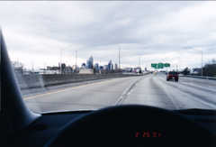
 The famous Gateway Arch
(left) greeted me as I crossed the Great River and reached the Real
West. I'd been to St. Louis before and found it to be a rather dull
place by urban standards, so aside from taking a rest stop on the
banks of the Mississippi, I kept driving. One new thing: I-70 though
the city had been renamed the Mark McGuire Expressway. The McGuire
took me past the airport through heavy afternoon traffic, and sent me
sailing across more empty plains at the new (for me) 70mph speed
limit. NPR was broadcasting Car Talk, which kept me entertained and
soothed me with sweet Bahstin accents.
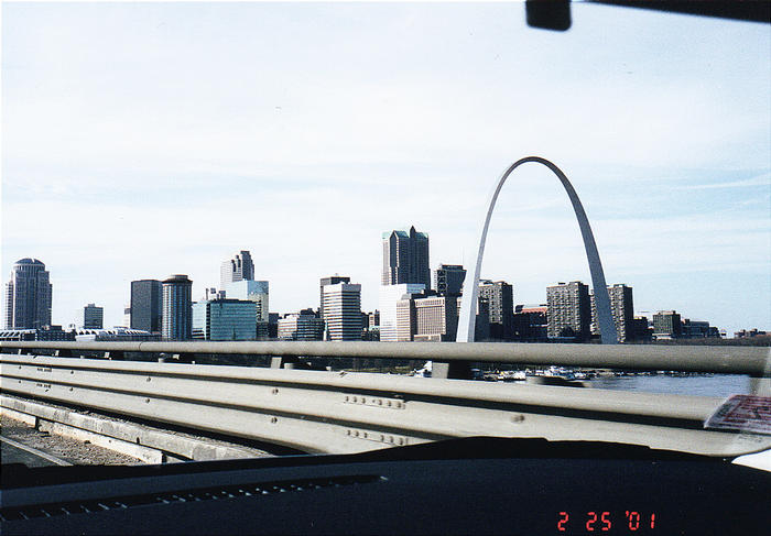
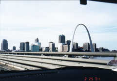
The famous Gateway Arch
(left) greeted me as I crossed the Great River and reached the Real
West. I'd been to St. Louis before and found it to be a rather dull
place by urban standards, so aside from taking a rest stop on the
banks of the Mississippi, I kept driving. One new thing: I-70 though
the city had been renamed the Mark McGuire Expressway. The McGuire
took me past the airport through heavy afternoon traffic, and sent me
sailing across more empty plains at the new (for me) 70mph speed
limit. NPR was broadcasting Car Talk, which kept me entertained and
soothed me with sweet Bahstin accents.
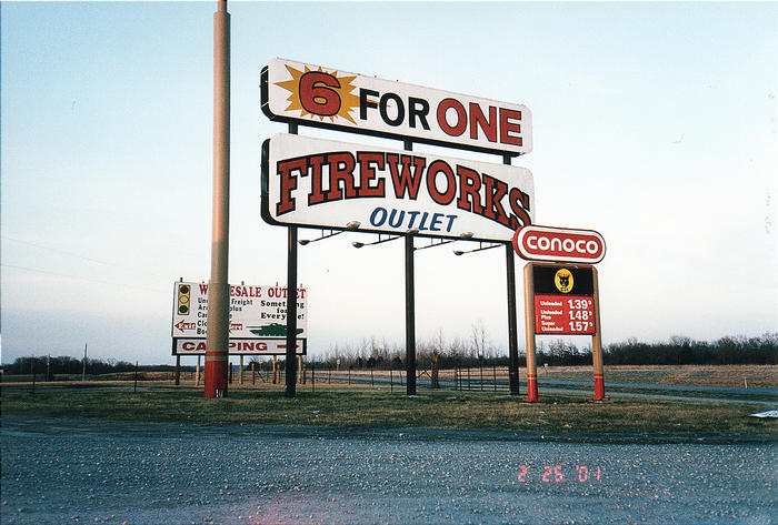
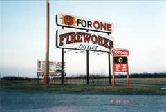 I don't remember much about central Missouri, except
for this photo of the gas station I stopped at (right). I regret that
I didn't stock up on fireworks. Six for one...what a deal!
I don't remember much about central Missouri, except
for this photo of the gas station I stopped at (right). I regret that
I didn't stock up on fireworks. Six for one...what a deal!
 The day ended with
comfort, friendship, and civilization as I drove into Kansas City at
sunset. I met my friend Yumi, an MIT graduate who is currently
attending graduate school and studying music composition at the
University of Missouri at Kansas City. We had dinner at a perfect
little Irish-style pub in the Country Club Plaza shopping district
(left), joined by our old friend Octopussy (who misses her old flame
The Octopus but refuses to admit it).
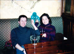
The day ended with
comfort, friendship, and civilization as I drove into Kansas City at
sunset. I met my friend Yumi, an MIT graduate who is currently
attending graduate school and studying music composition at the
University of Missouri at Kansas City. We had dinner at a perfect
little Irish-style pub in the Country Club Plaza shopping district
(left), joined by our old friend Octopussy (who misses her old flame
The Octopus but refuses to admit it).
I crashed at Yumi's place that night (it was good to avoid hotels,
even though my new employer would pay for it). Once again, I was up
bright and early, and hit the highway just before the morning rush.
My search for hot tea was getting rather difficult, though. I crossed
into Kansas a few blocks from Yumi's apartment (into Kansas City, KS),
then stopped at three fast-food joints looking for tea. They all had
iced tea, but looked puzzled when I asked for hot tea. Oh man, this
is going to be a rough trip.
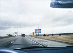
The day was a blur. I found tea at a rest stop on the Kansas Turnpike
(with whitener, of course), then set out across a bleak, flat,
featureless landscape. It was flatter than flat. I might as well have
watched six hours of a looping video featuring cornfields, a silo, a
farmhouse, and a watertower. Repeat. After the third repetition of
the week's Prairie Home Companion, even NPR got annoying. I passed
Russell, KS, the birthplace of Bob Dole, and stopped for lunch in
Hays. Suddenly, I had a cultural revelation. I was thrilled
to see a Wendy's! I even had an urge to stop in the Wal-Mart next
door. Now I understood--Wal-Mart and fast food aren't #1 in the US
because they're good, they're popular because they are the
only game in town for most of middle America! The Wendy's was
packed with people of all ages, hanging out in groups and chatting
happily over items from the Super Value Menu. What else is there to
do in Hays, Kansas? In Boston, we had Cornwall's. In Hays, they have
Wendy's. Who am I to criticize?
I-70 stretched out across the vast nothingness of western Kansas, and
a dull overcast rolled in and made it even more monotonous. Things
improved as I crossed into Colorado, because the sun came out, and
occasional rolling hills broke up the flatness. In fact, the golden
fields were quite beautiful in the afternoon sun. Unfortunately, I
lost contact with NPR momentarily and had to scan the dial for other
distractions. I stumbled into the cesspool of Colorado radio. Here I
experienced the vilest excesses of radical religious-right hate
speech. One station had tips for avoiding the upcoming tribulation
(brought on by a dot.com crash). Another station ranted on about how
scientists and college professors were poisoning our youth. The worst
talked about necessary "cultural warfare" and how the shooting of
abortion clinic doctors was illegal, but biblically justified. Oh,
and praise Jesus, too!
 I stopped in Denver to
visit an old friend, then started out early the next morning. A light
snow had fallen, covering I-25 and slowing traffic from Denver to
Cheyenne, WY (right).
I stopped in Denver to
visit an old friend, then started out early the next morning. A light
snow had fallen, covering I-25 and slowing traffic from Denver to
Cheyenne, WY (right).
Factoid: Wyoming, I've heard, was named after the Wyoming Valley in
Pennsylvania, home to Scranton and Wilkes-Barre. This is not as
interesting as the fact that Portland, OR was named after Portland,
ME. If a bet had gone the other way, it would have been named
Boston.
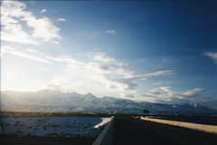
After all of the dull bleakness of the Great Plains, Wyoming was
wonderful. A few inches of new snow covered the rolling plains, and
as the sun peeked out from behind the clouds, I saw views that really
did look like something out of a Western. Now on I-80, I crossed the
Medicine Bow mountains as sunshine battled it out with light flurries
for domination of the day's weather. I crossed the Continental Divide
on a relatively flat plain at over 7,500', then descended slightly to
Rock Springs, where I had lunch. Again, it was fast food, and again,
it was a welcome sight.
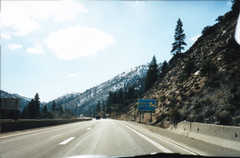
Wyoming finished with one more mountainous stretch, taking me through
Evanston, past Flaming Gorge (which I wanted to see but didn't have
the time to experience), and into Utah. I'd just been to Utah a few weeks earlier, but arriving there by car was
a different experience altogether. I passed Park City, drove through
Parley's Summit, and circled Salt Lake City via the beltway. I knew
this was the correct route, thanks to watching the local SLC TV
stations a few weeks before and learning that the I-80/I-15
interchange was partially closed. I found a really cool truck stop
just west of SLC.
 I headed west from SLC
just as the afternoon began to fade. I pulled off at some random exit
to check out the Great Salt Lake itself (left) which is indeed
extremely salty and rather smelly, too. From there, I rocketed west,
past Tooele, and into the first real desert I'd ever seen in my life.
It was dry, flat, sunny, and very brown. The bowl-shaped geometry of
each valley let one see the twenty miles of road ahead, and such a
view revealed that very few people drove this way.
I headed west from SLC
just as the afternoon began to fade. I pulled off at some random exit
to check out the Great Salt Lake itself (left) which is indeed
extremely salty and rather smelly, too. From there, I rocketed west,
past Tooele, and into the first real desert I'd ever seen in my life.
It was dry, flat, sunny, and very brown. The bowl-shaped geometry of
each valley let one see the twenty miles of road ahead, and such a
view revealed that very few people drove this way.
 I sped across the
desert on a ruler-straight interstate highway., with only the
occasional glimpse of salty water to the right to break up the flat brown
plain. Brown mountains capped in white snow walled this wasteland off
from the civilized world (or Salt Lake City). As the sun began to set
in the West, I stopped at Bonneville Salt Flats, still flooded with
shallow water from the winter rains (right).
I sped across the
desert on a ruler-straight interstate highway., with only the
occasional glimpse of salty water to the right to break up the flat brown
plain. Brown mountains capped in white snow walled this wasteland off
from the civilized world (or Salt Lake City). As the sun began to set
in the West, I stopped at Bonneville Salt Flats, still flooded with
shallow water from the winter rains (right).
As the sun set, I caught sight of the lights of Wendover. Wendover,
UT had an Air Force Base and a few very cheap hotels. Wendover, NV
had bright lights, high-rise casinos, porn shops, and live
entertainment of all sorts. I grabbed a $19.99 Motel-6 room and found
more fast food for dinner (even in a "resort" town, there wasn't a
decent restaurant). I wasn't up for casino entertainment, but I
cruised the strip anyway to see what they had to offer. Low-end vice
for repressed Utahns was about it.
 I made it onto the highway before sunrise the next
morning, fortified by yet another cup of Lipton with whitener. I was
getting used to it, really. A few miles outside of Wendover, I
crossed the first of many Nevadan mountain ranges and entered the
Pacific Time Zone, making it seem even earlier. Nevada was beautiful,
in a bleak sort of way (left). The sun rose behind snow-capped
mountains, revealing nothing but desert and more snow-capped
mountains. Some of these desert basins lacked a town or any sort of
stop-off. For the photo, I pulled off at some numbered exit and found
only an unmarked dirt road heading north and south. "Next services N
miles" was posted at each town, with N being less than 100 but seldom
less than 60. A half dozen mountain ranges brought me to the first
real population center, the town of Elko, NV. Here they had a busy
Main St., lined with bars, restaurants, shops, and dozens of casinos.
Every business in Nevada has a casino built-in--even fast-food
restaurants have a few slots in the corner. I had a very good
traditional breakfast at a large old-style diner. The diner adjoined
a full-service casino, and as I wandered to the back to search for
restrooms, I found that such places actually did respectable business
at 8:30am on a Wednesday morning. Why did it matter? There were no
windows, no clocks, and the bar was open, so why not gamble?.
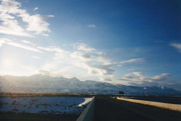
I made it onto the highway before sunrise the next
morning, fortified by yet another cup of Lipton with whitener. I was
getting used to it, really. A few miles outside of Wendover, I
crossed the first of many Nevadan mountain ranges and entered the
Pacific Time Zone, making it seem even earlier. Nevada was beautiful,
in a bleak sort of way (left). The sun rose behind snow-capped
mountains, revealing nothing but desert and more snow-capped
mountains. Some of these desert basins lacked a town or any sort of
stop-off. For the photo, I pulled off at some numbered exit and found
only an unmarked dirt road heading north and south. "Next services N
miles" was posted at each town, with N being less than 100 but seldom
less than 60. A half dozen mountain ranges brought me to the first
real population center, the town of Elko, NV. Here they had a busy
Main St., lined with bars, restaurants, shops, and dozens of casinos.
Every business in Nevada has a casino built-in--even fast-food
restaurants have a few slots in the corner. I had a very good
traditional breakfast at a large old-style diner. The diner adjoined
a full-service casino, and as I wandered to the back to search for
restrooms, I found that such places actually did respectable business
at 8:30am on a Wednesday morning. Why did it matter? There were no
windows, no clocks, and the bar was open, so why not gamble?.
 I-80 went from Elko
to Winnemucca, yet another town with truck stops and slot machines,
and from Winnemucca to the Edge of Civilization. Endless desert,
broken only by a few dry or salty lakes, lined the highway for hours
and hours of high-speed driving. I drove into glitzy yet geriatric
Reno by lunchtime, did two loops around the downtown strip, and
retired to yet another fast-food joint on the edge of town to get away
from the hoards of retirees. It wasn't Vegas, that's for sure. Then,
I drove the last 15 miles into the Sierra foothills and reached
California (right).
I-80 went from Elko
to Winnemucca, yet another town with truck stops and slot machines,
and from Winnemucca to the Edge of Civilization. Endless desert,
broken only by a few dry or salty lakes, lined the highway for hours
and hours of high-speed driving. I drove into glitzy yet geriatric
Reno by lunchtime, did two loops around the downtown strip, and
retired to yet another fast-food joint on the edge of town to get away
from the hoards of retirees. It wasn't Vegas, that's for sure. Then,
I drove the last 15 miles into the Sierra foothills and reached
California (right).
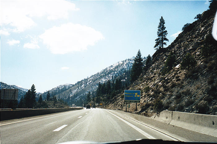
 I passed through the agricultural checkpoint, where I
delighted the inspectors by being the most distantly-registered car
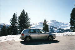
through the gate that day. I pulled off at the first rest stop and
"Vista Point" to snap a picture of myself and my car (left) at Donner
Summit.
I passed through the agricultural checkpoint, where I
delighted the inspectors by being the most distantly-registered car
through the gate that day. I pulled off at the first rest stop and
"Vista Point" to snap a picture of myself and my car (left) at Donner
Summit.
 It was California,
all right. As I started down the long grades of the western Sierra,
the sun got hotter, the temperatures rose, and for the first time my
air conditioning kicked in. It had been in the teens in Nevada that
morning, but as I approached Sacramento the green leaves of the
California winter opened up in front of me (right), along with the
brown haze of California car exhaust. I realized the true nature of
"that California smell" I'd noticed in my two previous visits--it was
tailpipe fumes. Mmm.
It was California,
all right. As I started down the long grades of the western Sierra,
the sun got hotter, the temperatures rose, and for the first time my
air conditioning kicked in. It had been in the teens in Nevada that
morning, but as I approached Sacramento the green leaves of the
California winter opened up in front of me (right), along with the
brown haze of California car exhaust. I realized the true nature of
"that California smell" I'd noticed in my two previous visits--it was
tailpipe fumes. Mmm.
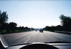
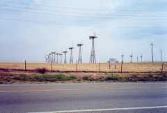 I-80 gained lanes and
accumulated cars, and I sat in my first California traffic jam at the
I-5 interchange. Down I-5, past orchards and fields of growing
things, over man-made canals and channels, past the shipping port of
Stockton (ocean freighters 50 miles inland?!?), and up the coast
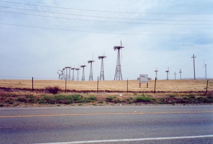
range hills past the windmills of Altamont Pass (left).
I-80 gained lanes and
accumulated cars, and I sat in my first California traffic jam at the
I-5 interchange. Down I-5, past orchards and fields of growing
things, over man-made canals and channels, past the shipping port of
Stockton (ocean freighters 50 miles inland?!?), and up the coast
range hills past the windmills of Altamont Pass (left).
I guess I was home now. Livermore looked quite nice in the winter.
The normally brown hills were still green from the winter rains. A
fog bank loomed to the west, spilling through Dublin Canyon from the
Bay to chill the folks in Pleasanton. I checked into my hotel and
began the long process of settling in.
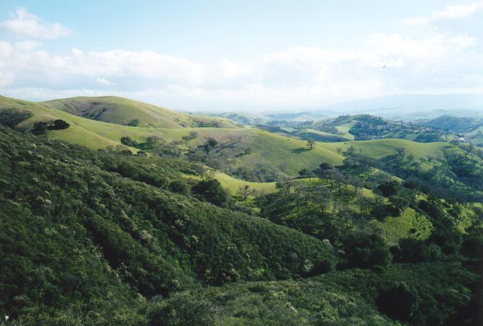
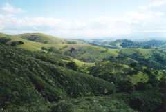 I took a few tours
of the area soon after arriving. The Livermore highlands, just north
of the city, presented an amazing landscape reminiscent of northern
Italy (right). Winding roads through the area offered all sorts of
pleasure-driving opportunities as long as one avoided shortcut-seeking
commuters.
I took a few tours
of the area soon after arriving. The Livermore highlands, just north
of the city, presented an amazing landscape reminiscent of northern
Italy (right). Winding roads through the area offered all sorts of
pleasure-driving opportunities as long as one avoided shortcut-seeking
commuters.
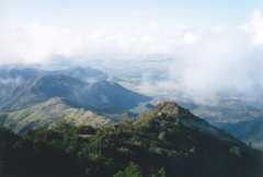 To the north, the
highlands rise up to the peaks of Mt. Diablo. At over 3,800', this
mountain looms over everything and even accumulates snow in the warm
Bay Area winters. The summit provides excellent views of San
Francisco, the bay, and the Altamont hills leading down into Livermore
(left).
To the north, the
highlands rise up to the peaks of Mt. Diablo. At over 3,800', this
mountain looms over everything and even accumulates snow in the warm
Bay Area winters. The summit provides excellent views of San
Francisco, the bay, and the Altamont hills leading down into Livermore
(left).
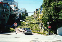 I even drove into SF itself to see all of the tourist
sites while I was still more of a tourist than a local. Everyone
wants to see Lombard St. (right)
I even drove into SF itself to see all of the tourist
sites while I was still more of a tourist than a local. Everyone
wants to see Lombard St. (right)
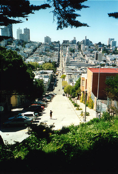
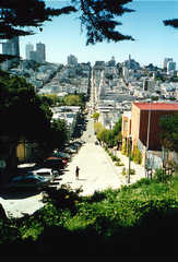 The view from Telegraph Hill into North Beach is rather
nice, too (left).
The view from Telegraph Hill into North Beach is rather
nice, too (left).
A week later, I'd moved into a new apartment in exciting Livermore,
giving up plans to live closer to the city in return for initial
convenience and access to a new job. Suburbia is clearly not my cup
of tea, but at least I found a nice place with reasonable access to
everything the Bay Area has to offer. I'm glad I had this
cross-country experience. Seeing how most of America lives made me
appreciate the civilized lifestyle I could get here in the land of
freeways and rolling blackouts. Sure, it's not Boston (it's not even
Philadelphia), but at least the StarbucksTM in the shopping
center next door will sell me Earl Grey with whole milk.
How's it going? Other trip reports and photo albums tell the
story!
Photos by Matthew Reagan
Back to Outdoor Adventures
 Over night, some rain moved in, washing the
accumulated grime off my still-unblemished car. I hit the road at
6am, and drove over the Ohio River into Ohio the State just as the sky
began to clear (right). So began a long and tedious day of
driving.
Over night, some rain moved in, washing the
accumulated grime off my still-unblemished car. I hit the road at
6am, and drove over the Ohio River into Ohio the State just as the sky
began to clear (right). So began a long and tedious day of
driving.